Rivers are quietly the most accessible countryside in Britain. A river needs a level path along it, so towpaths and riverside promenades tend to be flat, surfaced and easy going — and where the banks get steep, an old boat will happily do the walking for you. From the horse-drawn boats of Llangollen to the lock-free Broads at Wroxham, the river cruises at Dartmouth and York, and the gentle islands in the Ness at Inverness, this is a guide built around the riverside experiences that welcome everyone. It runs through England, Wales and Scotland, with an honest access note on every stretch.
Every place here carries an access note drawn from public accessibility information. Many are genuinely level and step-free; a few reaches and villages are steeper or rougher, and we say so plainly rather than promise. Access details change, so we'd always ask you to confirm with the operator — especially for boat trips, where boarding arrangements vary. This guide grows as we add rivers.
England
The Thames at Richmond and Runnymede, the Wye at Symonds Yat, the Severn at Ironbridge, and the gentle Broads at Wroxham.
Richmond Riverside

A graceful curve of the Thames with a level, accessible promenade.
One of the loveliest reaches of the Thames, Richmond Riverside sweeps below terraced gardens and Georgian houses, with rowing boats, riverside cafés and the famous view from Richmond Hill just above.
Official information: Official website not yet identified.
Our tip Hire a rowing boat, or simply follow the level promenade upstream to Petersham Meadows.
Visiting — good to know
A largely level, surfaced riverside promenade — one of the more accessible stretches of the Thames (the hill up to the viewpoint is steep).
For blind & low-vision visitors The riverside promenade is level and well-defined with railings along much of the water — good to follow; watch the open river edge at the moorings and the slope up to the town.
Sensory A relaxed, leafy riverside that can get busy on sunny weekends with cafés and boats; generally calm, with gentle water and birdsong.
Access last checked 5 Jul 2026 — always confirm with the venue.
Worth watching
More Wikipedia
Henley-on-Thames

A handsome riverside town famous for rowing and its bridge.
Home of the Royal Regatta and the River & Rowing Museum, Henley sits on a graceful reach of the Thames spanned by an elegant 18th-century bridge, with boat trips and a riverside meadow.
Our tip Take a passenger-boat cruise up the regatta course from the bridge.
Access not yet checked — please confirm with the venue before you travel.
Worth watching
More Wikipedia
Runnymede

Historic Thames-side meadows with accessible paths.
The riverside meadows where King John sealed Magna Carta in 1215 are cared for by the National Trust, with memorials, art and a gentle stretch of the Thames Path along the water.
Our tip The 'Writ in Water' artwork and the Magna Carta memorial make a moving level walk.
Memberships and passes
- National Trust — parking included: National Trust members receive free car parking across Runnymede estate. Official terms (checked 21 Aug 2026)
Visiting — good to know
Level, mostly firm riverside meadow paths — among the more accessible Thames Path sections; can be muddy after rain.
For blind & low-vision visitors The riverside path is level but the meadow edge to the Thames is open and unfenced — stay on the defined path; the ground can be muddy and uneven.
Sensory Open, quiet water-meadows with birdsong — a calm, low-stimulation spot away from the road, rarely crowded.
Access last checked 5 Jul 2026 — always confirm with the venue.
Worth watching
More Wikipedia
Symonds Yat & the Wye

A famous rock viewpoint over a great loop of the Wye.
The River Wye carves a wooded gorge here on the England–Wales border, watched over by the Symonds Yat Rock viewpoint, with a hand-pulled ferry, canoeing and peregrine falcons below.
Official information: Official website not yet identified.
Our tip The Rock viewpoint has an accessible path; the riverside has a historic hand ferry.
Visiting — good to know
The Rock viewpoint is reached by a short accessible path; the riverside walks are gentler but the gorge sides are steep.
For blind & low-vision visitors The Rock viewpoint path is short and firm but ends at unfenced cliff edges high above the river — a serious fall hazard; a sighted guide is strongly advised, and the hand ferry crosses open water.
Sensory The riverside and viewpoint can be busy on fine weekends, but the wooded gorge is largely peaceful with river and birdsong.
Access last checked 5 Jul 2026 — always confirm with the venue.
Worth watching
- SYMONDS YAT ROCK || SPECTACULAR VIEW || ENGLAND TRAVEL VLOG #forestofdean #wyevalley 🏴 Joy's World, UK Channel
- Symonds Yat in 4 Minutes: The Wye Valley’s Crown Jewel” JayWalkTvUk
- SYMONDS YATT 🇬🇧 Wye Valley Walk | River Wye & Forest Views in 4K Alfreds Adventures
More Wikipedia
Dartmouth & the River Dart

A beautiful deep-water estuary with river cruises and a steam railway.
Where the River Dart meets the sea, Dartmouth is a town of narrow streets and a naval college, with river cruises up to Totnes and a steam railway along the opposite bank.
Our tip Take the river cruise to Totnes — a lovely, mostly step-free way to see the Dart.
Visiting — good to know
The town is hilly with steps, but the riverfront embankment is level and the passenger ferries and cruise boats offer accessible river views.
For blind & low-vision visitors The embankment riverfront is level and railed, though the town is steep and stepped; ferry and cruise pontoons have open drops to water where staff assist boarding.
Sensory A busy, characterful harbour town with boat and gull noise on the waterfront; the river itself and the far bank are calmer.
Access last checked 5 Jul 2026 — always confirm with the venue.
Worth watching
- Dartmouth Devon Pretty Historic Coastal Town Tour Snapshot Travel
- DARTMOUTH AND THIS ENGLAND STONEHOUSE & STROUD VIDEO UNIT
- England 2016 - cruise down the River Dart from Totnes to Dartmouth John Allen
More Wikipedia
The River Cam, Cambridge

The gentle Cam flowing behind Cambridge's historic colleges.
The River Cam glides past the 'Backs' of Cambridge's great colleges, beneath famous bridges; chauffeured punts are the classic way to see King's, Trinity and the Bridge of Sighs from the water.
Official information: Official website not yet identified.
Our tip Choose a chauffeured punt with step-assisted boarding rather than self-hire.
Visiting — good to know
Riverside paths along the Backs are largely level; punt boarding involves a step down — ask operators about accessible boarding.
For blind & low-vision visitors The Backs paths are largely level but the riverbank is open to the water; boarding a punt is a step down into an unstable boat — choose a chauffeured punt with assistance.
Sensory The Backs and punt stations are busy and lively in season with crowds and chatter; early mornings on the river are calm and quiet.
Access last checked 5 Jul 2026 — always confirm with the venue.
Worth watching
- CAMBRIDGE VLOG! 🛶 River Cam Punting, Colleges, Escape Room & BEST Food 🏫 UK Road Trip Vlog 1 🇬🇧 Brogan Tate
- Cambridge, England 🇬🇧 Cambridge Colleges, Hidden Gems & the River Cam | 4K Cinematic Krish Grows
- Walking Around Cambridge 🇬🇧 | Historic Colleges, River Cam & Beautiful City Views in 4K I Drone London Learners
More Wikipedia
The Avon at Stratford

The River Avon flowing past the Royal Shakespeare Theatre.
The gentle River Avon curves through Shakespeare's town past the Royal Shakespeare Theatre and Holy Trinity Church, with riverside gardens, a chain ferry and pleasure-boat trips.
Official information: Official website not yet identified.
Our tip The Bancroft Gardens riverside is level and a lovely accessible stroll.
Visiting — good to know
The riverside gardens and theatre are level and accessible; pleasure boats offer step-assisted river trips.
For blind & low-vision visitors The Bancroft Gardens riverside is level and defined, but the water and lock edges are largely unfenced — keep to the paths; pleasure-boat pontoons have staff assistance.
Sensory The riverside gardens are relaxed but can be busy around the theatre and swans; generally calm with gentle water sounds.
Access last checked 5 Jul 2026 — always confirm with the venue.
Worth watching
More Wikipedia
The Ouse at York

The River Ouse winding beneath the walls and bridges of York.
The Ouse flows through the heart of York beneath its medieval bridges, with riverside walks below the city walls and sightseeing cruises past the Guildhall and warehouses.
Official information: Official website not yet identified.
Our tip A river cruise is a relaxing, mostly accessible way to see the old city.
Visiting — good to know
Riverside paths are level in the city centre (occasionally flooded); sightseeing boats have step-assisted, part-accessible boarding.
For blind & low-vision visitors City-centre riverside paths are level but the river edge is often unfenced and can flood, and the staithes drop straight to the water; sightseeing boats assist boarding.
Sensory The city-centre riverside is lively and can be crowded, with pubs and boats; quieter upstream and early in the day.
Access last checked 5 Jul 2026 — always confirm with the venue.
Worth watching
- York, England: Virtual Stroll Along City Wall, Westminster, Shambles & River Ouse Tranquil Roads
- The River Ouse in the City of York Yorkshire England The Virtual Tourist
More Wikipedia
Knaresborough & the Nidd

A dramatic railway viaduct above a wooded river gorge.
The River Nidd carves a gorge below the cliff-top town of Knaresborough, crossed by a picture-perfect railway viaduct, with rowing boats, riverside cafés and a ruined castle above.
Our tip The riverside by the boats is the classic view up to the viaduct.
Visiting — good to know
The riverside level has cafés and rowing boats and is reachable, but the town above is steep with many steps.
For blind & low-vision visitors The riverside by the boats is reachable, but the town above is very steep and stepped, and the river edge and weir are open-water hazards.
Sensory A peaceful gorge with river sounds that can get busy by the rowing boats on fine days; the town above is quieter.
Access last checked 5 Jul 2026 — always confirm with the venue.
Worth watching
More Wikipedia
Ironbridge & the Severn
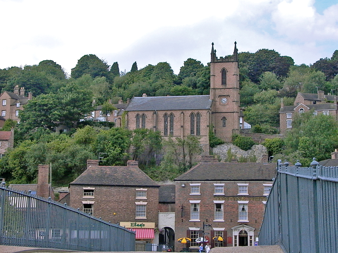
The world's first iron bridge arching over the River Severn.
In a wooded gorge of the River Severn, the world's first cast-iron bridge of 1779 gave its name to the valley where the Industrial Revolution began — now a World Heritage Site of museums.
Official information: Official website not yet identified.
Our tip The riverside path along the Severn gives the finest view of the bridge.
Visiting — good to know
The riverside towpath along the Severn is largely level and accessible; the bridge itself has a gentle ramped approach on one side.
For blind & low-vision visitors The riverside towpath is level and well-defined and the bridge deck has iron parapets to follow; the Severn edge alongside the path is largely unfenced.
Sensory A calm, green riverside setting with gentle water sounds; the bridge and cafés can be busy in season, but there is plenty of quiet towpath.
Access last checked 5 Jul 2026 — always confirm with the venue.
Worth watching
- Ironbridge Chris Witts of Severn Tales
- The River Severn Beauty Spots - Ironbridge - A Bikers Paradise! Get Some Sun With Paz
- Iron Bridge, Shropshire, England - 4K Video Eric The Hiking
More Wikipedia
Also featured in Shropshire
The Bure at Wroxham

Gentle lock-free waterways ideal for accessible boating.
Wroxham is the gateway to the Norfolk Broads, where the slow River Bure and its neighbours form a lock-free network of navigable water — some of the most boat-accessible scenery in Britain.
Official information: Official website not yet identified.
Our tip Several Broads day-boats and trip-boats are specifically wheelchair accessible.
Visiting — good to know
The Broads are exceptionally boat-friendly and lock-free; several operators run wheelchair-accessible trip boats and day boats — among the most accessible waterways in the UK.
For blind & low-vision visitors The staithes and boatyards are level but their edges drop straight to the water with little fencing; trip-boat crews assist boarding, and the boatyards give good audible cues.
Sensory A relaxed, watery setting with boatyard sounds; Wroxham gets busy in summer, but out on the Broads it is calm and quiet.
Access last checked 5 Jul 2026 — always confirm with the venue.
Worth watching
- 🔴 The Norfolk Broads LIVE - Wroxham, Potter Heigham & Ranworth Broad Walk With Me Tim
More Wikipedia
Also featured in Three days on the Norfolk and Suffolk coast
The Tees at Yarm

A handsome high street town wrapped by a loop of the Tees.
The River Tees loops almost all the way around the elegant Georgian town of Yarm, crossed by a great railway viaduct, with a broad cobbled high street and riverside walks.
Our tip The riverside walk under the viaduct is a gentle, level stroll.
Visiting — good to know
The riverside path is largely level; the historic high street has cobbles in places.
For blind & low-vision visitors The riverside path under the viaduct is level and defined, though the high street has cobbles and the river edges are open.
Sensory A quiet, handsome riverside town that rarely feels crowded, with gentle water and the occasional train on the viaduct.
Access last checked 5 Jul 2026 — always confirm with the venue.
More Wikipedia
Wales
The Wye at Tintern, the horse-drawn boats of Llangollen on the Dee, and the Usk at Brecon.
Tintern & the Wye

The romantic Cistercian abbey beside the winding Wye.
The soaring ruins of Tintern Abbey stand beside the River Wye in its wooded valley, immortalised by Wordsworth and Turner — one of the most beautiful river settings in Britain.
Our tip The abbey itself sits on the flat valley floor beside the river.
Visiting — good to know
The abbey and riverside are on level valley-floor ground and largely accessible; the surrounding Wye Valley walks are steep.
For blind & low-vision visitors The abbey and riverside are on level, well-defined valley-floor ground; the Wye's bank is open water beyond the grass.
Sensory A tranquil, wooded valley with river and birdsong — a calm, low-stimulation setting; the abbey can be busy on fine weekends.
Access last checked 5 Jul 2026 — always confirm with the venue.
Worth watching
More Wikipedia
Llangollen & the Dee

A river town with a horse-drawn canal boat and a world-famous aqueduct.
The River Dee tumbles through Llangollen beneath a medieval bridge, while above the town the canal carries boats — including a horse-drawn trip boat — across Telford's breathtaking Pontcysyllte Aqueduct.
Our tip The horse-drawn canal boat and the aqueduct trip are gentle and part-accessible.
Visiting — good to know
The riverside and canal wharf are largely level; the horse-drawn boat and canal trips offer accessible, gentle water journeys (the aqueduct towpath has a sheer edge).
For blind & low-vision visitors The riverside and canal wharf are largely level, but the Dee is fast with an unfenced edge and the canal-boat wharf has open water (crews assist); avoid the aqueduct towpath, which has a sheer unfenced drop.
Sensory The rushing Dee gives constant water noise; the town and canal wharf are lively in season, with quieter stretches along the towpath.
Access last checked 5 Jul 2026 — always confirm with the venue.
Worth watching
- Llangollen - The Most Picturesque Town | British Sightseeing British Excellence
- Exploring Llangollen: A POV Walk Featuring the Steam Railway, River Dee & More! Taking Time Back
More Wikipedia
Cenarth Falls & the Teifi

A pretty village where the Teifi tumbles over rocky falls.
The River Teifi drops over a series of rocky falls at Cenarth, a famous spot for watching salmon leap and for the ancient craft of coracle fishing, with a National Coracle Centre nearby.
Official information: Official website not yet identified.
Our tip The falls are visible from near the road bridge with only a short walk.
Visiting — good to know
The falls are a short walk from the car park and partly viewable near-level; riverside rocks and paths are uneven.
For blind & low-vision visitors The falls are a short walk from the car park, but the riverside rocks are uneven and wet with open water — keep to the viewing points and use a guide near the falls.
Sensory A small, peaceful village where the main sound is the falls; it can get busy by the bridge on fine days but is generally calm.
Access last checked 5 Jul 2026 — always confirm with the venue.
Worth watching
More Wikipedia
Brecon & the Usk
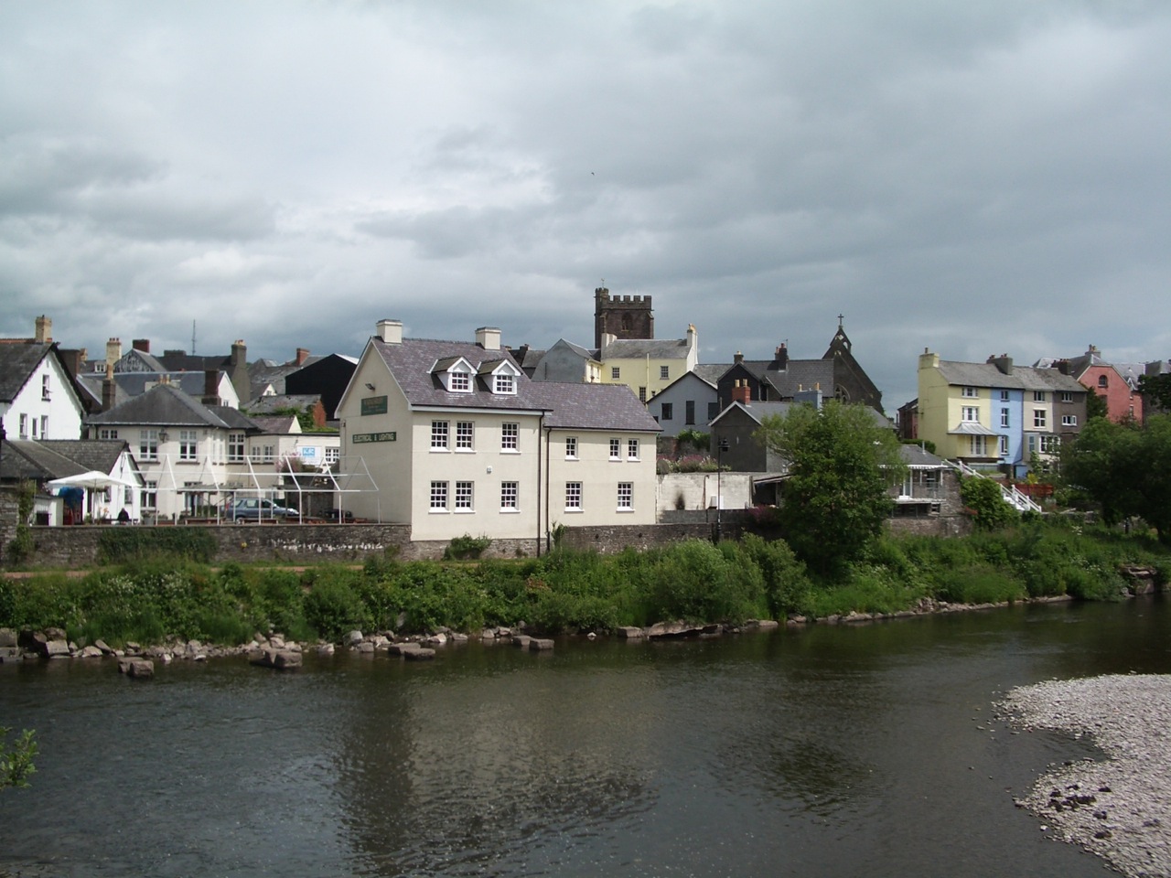
The River Usk and a canal basin below the Brecon Beacons.
The River Usk and the little River Honddu meet at Brecon, gateway to the Beacons, where a restored canal basin offers gentle narrowboat trips and a level towpath through the hills.
Official information: Official website not yet identified.
Our tip The Monmouthshire & Brecon Canal towpath is a gentle, accessible waterside route.
Visiting — good to know
The canal towpath from Brecon is level and largely accessible; the riverbanks of the Usk are more natural and uneven.
For blind & low-vision visitors The canal towpath is level, defined and easy to follow, with the water unfenced on one side — keep to the landward edge; the Usk's banks are natural and uneven.
Sensory A calm, rural canal-and-river setting with birdsong and gentle water; the towpath is quiet and low-stimulation.
Access last checked 5 Jul 2026 — always confirm with the venue.
More Wikipedia
Scotland
The Ness Islands at Inverness, the Tay at Perth and Dunkeld, the Spey at Aviemore, and the Tweed at Melrose.
Ness Islands, Inverness

Tranquil islands in the River Ness, reached by level paths.
In the heart of Inverness, the River Ness flows around a chain of wooded islands linked by Victorian suspension footbridges — a beautiful, tranquil riverside walk right in the city.
Official information: Official website not yet identified.
Our tip The riverside path and island bridges make a lovely level circular walk.
Visiting — good to know
The riverside paths and most island footbridges are level and accessible — an unusually easy and beautiful river walk in a city.
For blind & low-vision visitors The island paths and most footbridges are level and well-defined — an unusually easy river walk — but the bridges and banks have open, fast water on both sides.
Sensory A tranquil, wooded riverside walk in the city — calm and quiet, with the constant gentle sound of the fast river.
Access last checked 5 Jul 2026 — always confirm with the venue.
Worth watching
More Wikipedia
Perth & the River Tay
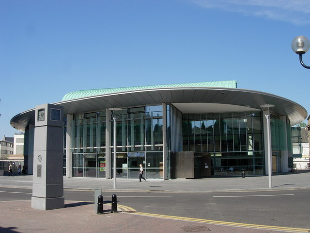
The broad River Tay, Britain's largest by flow, through Perth.
The River Tay — the largest river in Britain by volume — sweeps past the parks and Georgian terraces of Perth, with riverside walks, salmon runs and the green expanse of the North and South Inch.
Our tip The Inches parks give long, flat, accessible riverside walking.
Visiting — good to know
The riverside parks (the Inches) are broad, level and accessible — easy walking beside a great river.
For blind & low-vision visitors The Inches riverside parks are broad, flat and well-defined, but the Tay's edge is largely unfenced and the river is powerful — keep back from the bank.
Sensory The riverside parks are open, calm and rarely crowded, with the broad river and birdsong; the city is just behind.
Access last checked 5 Jul 2026 — always confirm with the venue.
Worth watching
More Wikipedia
Dunkeld & the Tay
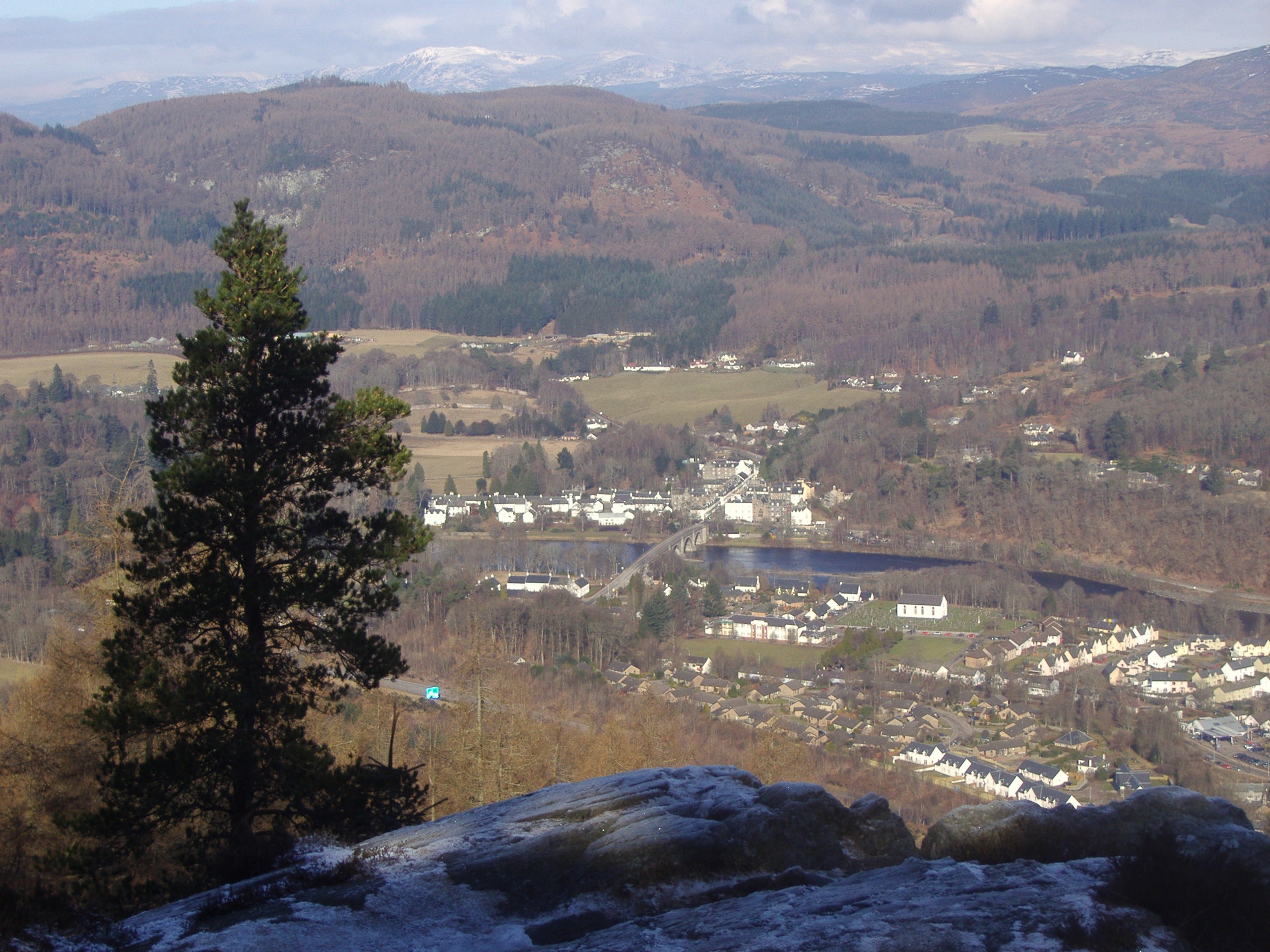
A ruined cathedral beside the salmon-rich River Tay.
The little cathedral village of Dunkeld sits where the River Tay runs broad and clear through Perthshire's 'big tree country', with riverside walks, salmon and the wooded Hermitage nearby.
Our tip The cathedral and its riverside setting are on gentle, mostly level ground.
Memberships and passes
- National Trust for Scotland — parking included: National Trust for Scotland members receive free car parking at The Hermitage. Official terms (checked 21 Aug 2026)
Visiting — good to know
The cathedral and village riverside are largely level; the nearby Hermitage forest walk to the falls has steps.
For blind & low-vision visitors The cathedral and village riverside are largely level and defined with the Tay bank open to the water; the nearby Hermitage has steps and unfenced drops to the falls.
Sensory A peaceful cathedral village with river sounds and birdsong — calm and low-key, busier only around the car parks on fine days.
Access last checked 5 Jul 2026 — always confirm with the venue.
Worth watching
- Dunkeld & The Hermitage - Martin's Mostly Accurate Tour Martin Ritchie
- Dunkeld - The Gateway to the Highlands Highland Explorer
More Wikipedia
Aviemore & the Spey

The fast, clear River Spey beneath the Cairngorms.
One of Scotland's great rivers, the fast and famous Spey runs through the Cairngorms near Aviemore — celebrated for salmon, whisky and, on gentler sections, family river journeys.
Official information: Official website not yet identified.
Our tip The Speyside Way has level riverside sections near the villages.
Visiting — good to know
Riverside sections of the Speyside Way near the villages are gentle and partly accessible; the wider strath is a mix of terrain.
For blind & low-vision visitors Riverside sections near the villages are gentle and partly defined, but the banks are natural, uneven and drop to a fast river — a guide helps off the made paths.
Sensory A calm, open riverside among the pines with birdsong and water; the village itself is busier, especially in the ski and summer seasons.
Access last checked 5 Jul 2026 — always confirm with the venue.
Worth watching
- Hiking 28km on the Speyside Way: Aviemore to Grantown-on-Spey Average Adventurer
More Wikipedia
New Lanark & the Clyde

A restored cotton-mill village above the Falls of Clyde.
The River Clyde powered the cotton mills of New Lanark, now a beautifully restored World Heritage village, with a nature reserve upstream leading to the dramatic Falls of Clyde.
Our tip The village is level and accessible; the falls walk beyond is steeper.
Visiting — good to know
The World Heritage village itself is level, surfaced and largely accessible; the riverside path to the Falls of Clyde becomes steeper and stepped.
For blind & low-vision visitors The World Heritage village is level, surfaced and well-defined, but beyond it the riverside path to the falls becomes steep and stepped above a gorge with open drops.
Sensory The mill village can be busy with visitors and has some machinery sound, but the riverside walk beyond is calm and full of water and birdsong.
Access last checked 5 Jul 2026 — always confirm with the venue.
Worth watching
- New Lanark- UNESCO World Heritage Site | Falls of Clyde | Lanark | Family Day Out | Scotland Country Roads and Blue Skies
- New Lanark and Falls of Clyde, Scotland Nigel Cole
- Lanark | This Scottish Town Has a SECRET Village You Must See To Believe RogEdwardsTV
More Wikipedia
Melrose & the Tweed

The salmon river of the Borders beside a great ruined abbey.
The River Tweed — one of the world's great salmon rivers — flows past Melrose and its soaring pink-stone abbey, with riverside walks, the Southern Upland Way and views to the Eildon Hills.
Our tip The riverside path by the abbey and chain bridge is a gentle level walk.
Visiting — good to know
The abbey and the riverside path by the Tweed are largely level and accessible; longer Borders walks are hillier.
For blind & low-vision visitors The abbey and the riverside path by the Tweed are largely level and defined with the bank open to a strong river — keep to the path; the chain bridge sways underfoot.
Sensory A quiet, genteel Borders town with a calm riverside; the abbey can be busy on fine days but the Tweed banks are peaceful.
Access last checked 5 Jul 2026 — always confirm with the venue.
Worth watching
- Melrose River Tweed | Our Amazing Riverside Walk in the Scottish Borders Motorhoming Fun.
- The River Tweed Melrose Maxton House Cottages
More Wikipedia
Before you go
Rivers reward the gentle traveller, but a few honest tips: the best accessible days combine a level towpath or promenade with a boat trip, so check each place's access note and the operator's boarding arrangements before you go. Riverside paths can flood or turn muddy after heavy rain. And if you'd like to build a trip around a few, open the planner and shape it around how you travel — with your own access needs applied throughout.