Shropshire holds a remarkable secret for such a quiet county: the modern world began here. In 1779 the world's first iron bridge was thrown across the Severn at what is now a World Heritage gorge, and the Industrial Revolution followed. Yet Shropshire wears its history lightly — around the gorge lie one of England's finest black-and-white towns at Shrewsbury, the food-lover's citadel of Ludlow, and the "blue remembered hills" of A. E. Housman, the Long Mynd and Stiperstones rolling away to the Welsh border. This is a guide to the best of it, grouped by area, with an honest note on access at each stop.
Shropshire has a genuinely strong accessibility spread, and we flag it where it's confirmed — the fully step-free RAF Museum at Cosford, Attingham Park's level parkland, the accessible lower path at Carding Mill Valley, the accessible carriages of the Severn Valley Railway. It also has some seriously hard country — the open hills of the Long Mynd and Stiperstones, the caves and ladders of Hawkstone — and we say so plainly rather than pretend. Access details change, so confirm with each site before you go. This guide grows as we add places.
Ironbridge and the Severn Gorge
Where the Industrial Revolution was born — the Iron Bridge itself and the great museums of the gorge.
The Iron Bridge
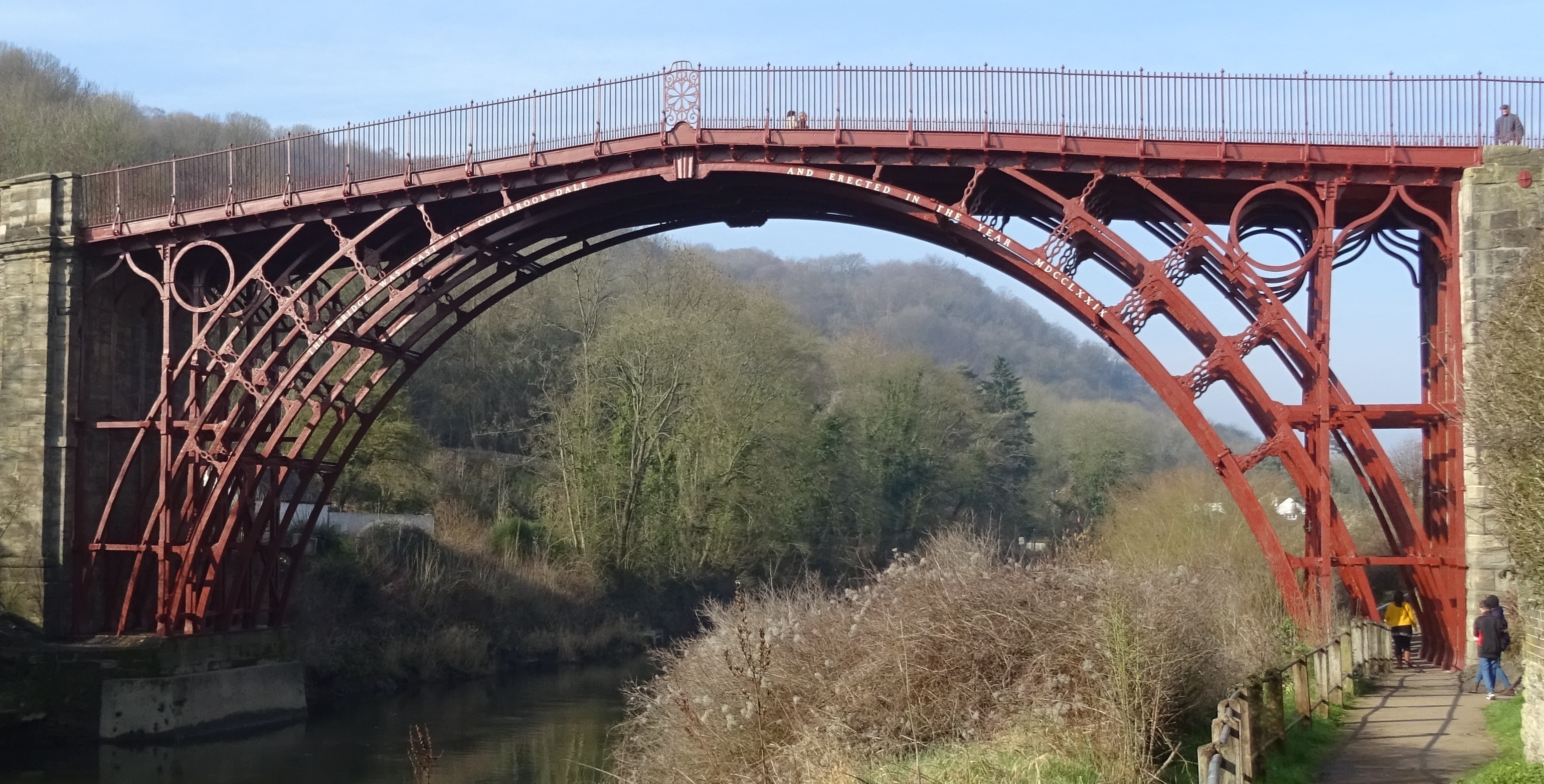
The 1779 cast-iron bridge that gave the gorge and the era their name.
Abraham Darby III's great arch of 1779 was the first bridge in the world built of iron — the symbol of a World Heritage valley where the Industrial Revolution took shape beside the River Severn.
Our tip The riverside path gives the classic view; the bridge deck is open to walk across.
Visiting — good to know
The riverside towpath is largely level and accessible; the bridge deck has a gentle ramped approach from the town side.
For blind & low-vision visitors The riverside towpath is level and well-defined and the bridge deck has iron parapets to follow; the Severn edge alongside is largely unfenced.
Sensory A calm, green riverside setting with gentle water sounds; the bridge and cafes can be busy in season, but there is plenty of quiet towpath.
Access last checked 5 Jul 2026 — always confirm with the venue.
Worth watching
- Iron Bridge | 10 Places That Made England with Dan Snow English Heritage
- The world famous Iron bridge, Shropshire, UK. VideoHistoryToday
More Wikipedia
Also featured in Accessible riverside Britain
Blists Hill Victorian Town

A living museum where costumed streets bring the 1900s to life.
The largest of the Ironbridge Gorge Museums, Blists Hill recreates a Victorian industrial town — bank, sweet shop, pub and foundry staffed by costumed characters, with old-money to spend.
Our tip Allow a full day; there's a lot of ground and plenty to do.
Visiting — good to know
Mostly level site with firm paths, though there are cobbles and a few slopes; a mobility-scooter/wheelchair loan is usually available — check ahead.
For blind & low-vision visitors The site is mostly level but has cobbled streets, uneven yards and working machinery — busy and audible; a mobility loan and a guide help, and the costumed staff give good verbal orientation.
Sensory A lively, immersive Victorian town with costumed characters, machinery and crowds - sensory-rich and can be busy; calmer areas across the large site.
Access last checked 5 Jul 2026 — always confirm with the venue.
Worth watching
- Blists Hill - Living Victorian Town - A Complete Tour - Ironbridge Postcard And A Pint
- Ironbridge Gorge, England: Blists Hill Victorian Town - Rick Steves’ Europe Travel Guide Rick Steves' Europe
More Wikipedia
Coalbrookdale Museum of Iron

The birthplace foundry of the iron age of industry.
In the wooded Coalbrookdale valley stands the furnace where Abraham Darby first smelted iron with coke in 1709 — the breakthrough that made the Iron Bridge, and the modern world, possible.
Our tip The Old Furnace is dramatically displayed under cover beside the museum.
Visiting — good to know
The museum galleries are accessible with level access and a lift; the surrounding valley paths are steeper.
For blind & low-vision visitors The galleries are level with a lift and clear routes, though the surrounding valley paths are steeper and uneven; the furnace area's drops are guarded by rails.
Sensory A calm museum in a wooded valley of birdsong - a low-stimulation space, gently busy in holidays.
Access last checked 5 Jul 2026 — always confirm with the venue.
Worth watching
- Museum Of Iron, Coalbrookdale, Telford 10.9.20 Mr Williams 26TC597
More Wikipedia
Coalport China Museum

A riverside china works with bottle kilns and workshops.
Beside the Severn and the Shropshire Canal, the Coalport works once made some of the finest porcelain in Britain; its bottle kilns and decorating shops now tell that delicate story.
Our tip Combine it with a walk along the towpath to the Hay Inclined Plane.
Visiting — good to know
The riverside museum has largely level access; some workshop areas and the towpath beyond are uneven.
For blind & low-vision visitors The riverside museum is largely level and defined, but some workshop areas and the towpath are uneven with open water along the canal and river.
Sensory A calm riverside museum of water sound and birdsong - peaceful and low-key, gently busy on fine days.
Access last checked 5 Jul 2026 — always confirm with the venue.
Worth watching
- The Coalport China Museum Britain Unbound
More Wikipedia
Ludlow Castle
A magnificent ruined medieval castle overlooking the River Teme, rich in royal history.
A magnificent ruined medieval castle overlooking the River Teme, rich in royal history.
Our tip The outer bailey and paths are firm gravel; the inner bailey has step-free paths, but castle towers have steep spiral steps.
Plan your visit
- Opening
- Open daily 10am – 5pm; last entry 4.15pm.
- Admission
- Adult admission is £10, child admission for ages 5–15 is £5, family admission is £28, and children under 5 are free.
- Booking
- Tickets are also available to purchase on arrival.
Visitor information checked 13 Jul 2026. Opening and prices can change.
Visiting — good to know
Partial wheelchair access Accessible toilets
For blind & low-vision visitors A 3D model beside the ticket office can help visitors with visual impairments understand the castle layout.
Vision services The model has braille and Moon system labels.
Access last checked 13 Jul 2026 — always confirm with the venue.
Worth watching
- LUDLOW, SHROPSHIRE Travel Guide - A Day in the Historic Market Town! Winsper's Travel Vids
More Tickets · Venue access information · Wikipedia
Shrewsbury and the North
The black-and-white county town, the level parkland of Attingham, a Roman city and the follies of Hawkstone.
Shrewsbury

A medieval and Tudor county town almost encircled by the Severn.
Nearly wrapped by a great loop of the River Severn, Shrewsbury is one of England's finest Tudor towns — a maze of timber-framed 'shuts' and passages, a red-sandstone castle and riverside parks.
Official information: Official website not yet identified.
Our tip The Quarry park and its Dingle gardens give a lovely level riverside stroll.
Visiting — good to know
The Quarry riverside park is level and accessible; the medieval town centre is hilly with some cobbled lanes and steps.
For blind & low-vision visitors The Quarry riverside park is level and well-defined, but the medieval town is a maze of narrow, stepped 'shuts' with cobbles and poor contrast — a guide helps in the centre.
Sensory A calm, characterful Tudor river town - gently busy in the centre and market, with the quiet riverside Quarry park as a refuge.
Access last checked 5 Jul 2026 — always confirm with the venue.
Worth watching
- Uk's Happiest Town? Shrewsbury, United Kingdom, a quick guide. Jack Of All Escapes
- Shrewsbury Shropshire England | Town Walk 2025 | No AI used Let's Explore UK
- Secrets of Shrewsbury- A Guided Tour Roy Rogers
More Wikipedia
Attingham Park

A Regency mansion in sweeping, accessible parkland.
One of the National Trust's most-loved estates, Attingham pairs an elegant Regency mansion with a walled garden and a vast deer park laid out along the River Tern.
Our tip The mile-long parkland walk is firm and largely level — a popular accessible route.
Visiting — good to know
The main parkland walk and walled garden have firm, mostly level surfaces and are well set up for wheelchairs and buggies; the mansion has some steps with a lift.
For blind & low-vision visitors The main parkland walk is firm, level and well-defined — easy to follow — and the mansion is reached step-free by lift; the deer park is open with occasional uneven ground.
Sensory A calm, spacious deer park and mansion of birdsong - peaceful and open, busier near the house and cafe.
Access last checked 5 Jul 2026 — always confirm with the venue.
Worth watching
- Amazing Attingham Park (May 2025) Violin Pilgrimages & Cognoscenti
More Wikipedia
Wroxeter Roman City
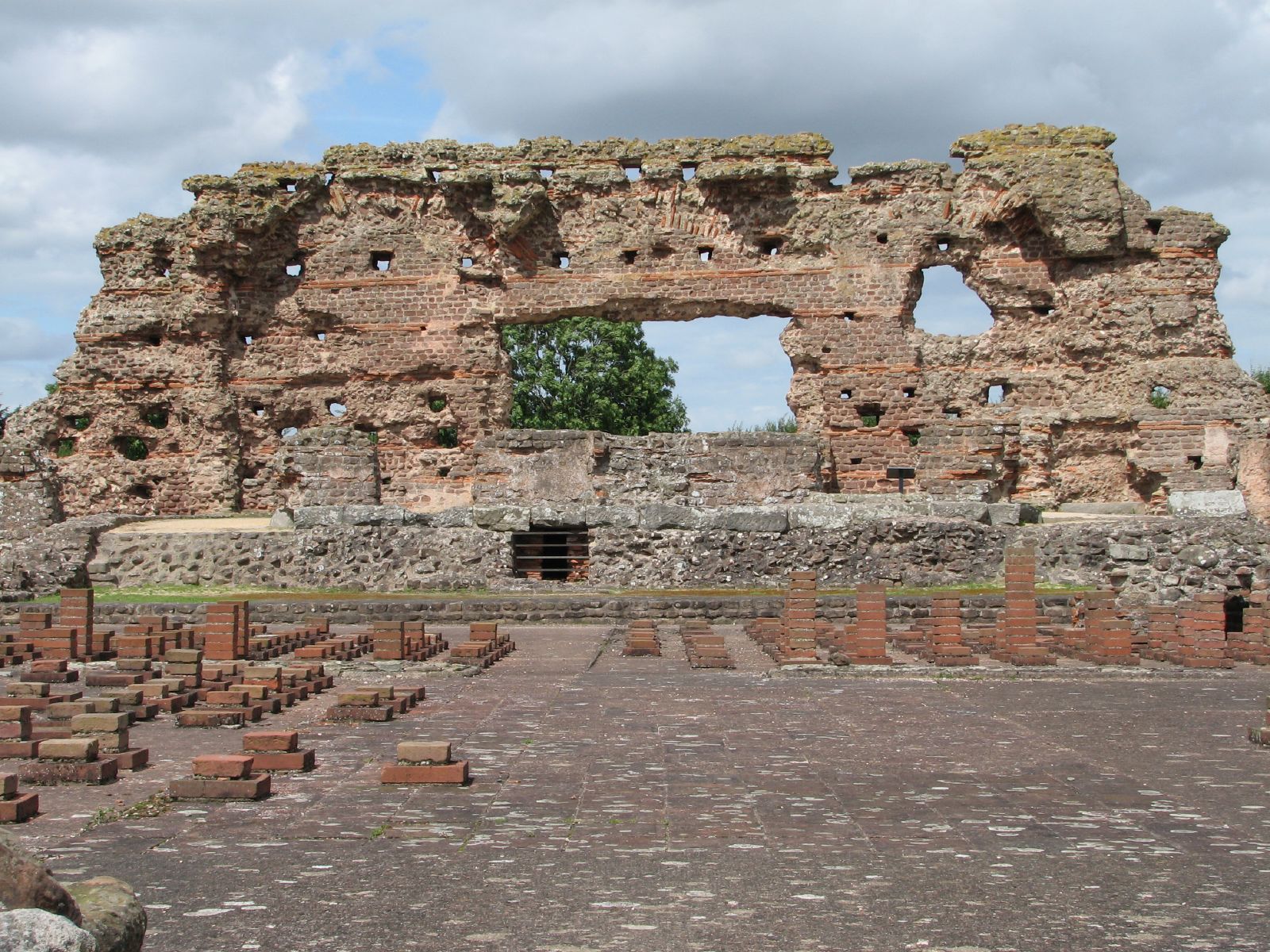
The ruins and rebuilt villa of a great Roman city.
Once Viroconium, the fourth-largest city in Roman Britain, Wroxeter preserves the towering 'Old Work' of its bathhouse and a full-scale reconstructed Roman town house built using period methods.
Our tip The reconstructed villa really brings Roman daily life to life.
Visiting — good to know
The site is mostly level grass and firm paths, giving good access to the ruins and reconstruction; grass can be soft after rain.
For blind & low-vision visitors The site is mostly level grass and firm paths with the ruins guided by low walls, and the reconstructed villa gives a tactile sense of a Roman house; grass can be soft after rain.
Sensory A calm, open, rural Roman site of birdsong and wide skies - peaceful and quiet.
Access last checked 5 Jul 2026 — always confirm with the venue.
Worth watching
- WROXETER ROMAN CITY | Exploring Life in a RUINED ROMAN City Pinned on Places
- Wroxeter Roman City | Virtual Tour of Wroxeter, Viroconium British History
More Wikipedia
Hawkstone Park Follies

Cliffs, caves, towers and tunnels in a wooded parkland.
A theatrical Georgian landscape of sandstone cliffs, hidden caves, a grotto and a hilltop tower, Hawkstone's follies were designed to thrill and disorientate — an adventure of a walk.
Official information: Official website not yet identified.
Our tip Wear sturdy footwear and bring a torch for the tunnels.
Visiting — good to know
This is a strenuous adventure of steep steps, ladders, caves and narrow tunnels — not accessible, and not suitable for those unsteady on their feet.
For blind & low-vision visitors Not recommended for VI visitors without a guide: steep steps, ladders, dark caves and narrow, unlit tunnels with sudden drops make this a disorienting and hazardous adventure.
Sensory A dramatic, disorienting adventure of caves and tunnels - can feel intense and enclosed; the wooded parkland around is calmer and airy.
Access last checked 5 Jul 2026 — always confirm with the venue.
Worth watching
- Exploring Hawkstone Park Follies Adam Explores Britain
- Hawkstone Park Follies - UK's best hidden gem! Nature and hikes in England. Jack Of All Escapes
- Hawkstone Park & Follies – Nature, Rocks & Secret Paths JAF trips
More Wikipedia
Ellesmere & the Meres

A cluster of glacial lakes around a pretty canal town.
A scatter of nine glacial 'meres' gives this corner of north Shropshire a quiet lake-district charm; the Mere at Ellesmere has a lakeside path, boat hire and a visitor centre.
Official information: Official website not yet identified.
Our tip The lakeside path around the Mere is a gentle, accessible circuit.
Visiting — good to know
The main lakeside path at the Mere is largely level and accessible, with benches and a visitor centre.
For blind & low-vision visitors The lakeside path is largely level and well-defined with the water unfenced on one side — keep to the landward edge; the visitor centre gives orientation.
Sensory A calm, watery lakeside of birdsong - peaceful and open, gently busy at the visitor centre and cafe.
Access last checked 5 Jul 2026 — always confirm with the venue.
Worth watching
- Ellesmere, Shropshire, England (with captions). Walking with Bill
- Ellesmere - The Mere view UK 4k Phantom 3 Adrian Crucianu
More Wikipedia
Oswestry & Old Oswestry Hillfort

A market town crowned by one of Britain's finest Iron Age hillforts.
A spirited border town of mixed Welsh and English character, Oswestry sits below Old Oswestry — a vast, beautifully preserved Iron Age hillfort with dramatic multiple ramparts.
Our tip The hillfort ramparts reward the climb with wide border views.
Visiting — good to know
The town is fairly level; the hillfort itself is reached by a grass climb over uneven ramparts — not accessible.
For blind & low-vision visitors The town is fairly level, but the hillfort is reached by a grass climb over steep, uneven ramparts with unfenced drops — a guide is needed there.
Sensory A calm, characterful border town - gently busy on market days; the hillfort above is wild, open and quiet.
Access last checked 5 Jul 2026 — always confirm with the venue.
Worth watching
- Oswestry | Shropshire, England Walking with Bill
- Old Oswestry Hill Fort. Shropshire England. Britannia Unconsidered
More Wikipedia
The Shropshire Hills
Housman's country — Church Stretton, the Long Mynd and Carding Mill Valley, the eerie Stiperstones and Wenlock Edge.
Church Stretton

A Victorian resort town beneath the Long Mynd.
Tucked between the Long Mynd and Caer Caradoc, Church Stretton grew as a Victorian health resort; today it's the walkers' capital of the Shropshire Hills, with a pretty centre and hill trails.
Our tip It's the ideal base for the hills, with a station on the line.
Visiting — good to know
The town centre is largely level and accessible; the surrounding hills are steep, open walking.
For blind & low-vision visitors The town centre is largely level and defined, but step onto the hills and the ground becomes steep, open and pathless — not for VI visitors alone.
Sensory A calm walkers town - gently busy in the centre, with the wild, open, quiet hills all around.
Access last checked 5 Jul 2026 — always confirm with the venue.
Worth watching
- CHURCH STRETTON | 4K Walking Tour of Beautiful Town in Shropshire, UK Dan's Walking Tours UK
More Wikipedia
Carding Mill Valley

A popular National Trust valley with a stream and tea room.
A beautiful valley cutting into the Long Mynd, Carding Mill draws families to its stream, waterfalls and grassy banks, with a National Trust tea room and gentle lower paths.
Official information: Official website not yet identified.
Our tip The lower valley path by the stream is the accessible, family-friendly part.
Memberships and passes
- National Trust — parking included: National Trust members receive free parking in Carding Mill Valley. Official terms (checked 21 Aug 2026)
Visiting — good to know
The lower valley has a firm, largely level path by the stream suitable for many wheelchair users and buggies; the walk up onto the Mynd becomes steep and rough.
For blind & low-vision visitors The lower valley path by the stream is firm and largely level with the water alongside (open edge); beyond, the climb onto the Long Mynd is steep, uneven and exposed.
Sensory A calm, popular valley of stream sound and birdsong - busy at the tea room and lower valley on fine days, wilder and quieter above.
Access last checked 5 Jul 2026 — always confirm with the venue.
Worth watching
- CARDING MILL VALLEY | 4K Walking Tour of the Best Hiking Destination in Shropshire, UK Dan's Walking Tours UK
More Wikipedia
The Long Mynd
A high heather plateau of huge views and hidden valleys.
A long ridge of ancient heath and bracken rising above Church Stretton, the Long Mynd offers some of the Marches' finest walking, with skylarks, wild ponies and views to the Welsh mountains.
Official information: Official website not yet identified.
Our tip The 'Burway' road climbs high onto the ridge for an easier taste of the tops.
Visiting — good to know
Open, exposed moorland walking on steep and uneven ground — not accessible on foot, though the narrow Burway road gives high views from a car.
For blind & low-vision visitors Open, pathless moorland with steep, uneven ground and hidden gullies — hazardous for VI visitors on foot; the high views are best reached by car on the Burway.
Sensory A vast, wild, open moor of wind and skylarks - profoundly calm and remote, the Burway road busier on fine days.
Access last checked 5 Jul 2026 — always confirm with the venue.
Worth watching
- Shropshire Hills: The Long Mynd and Pole Bank Walking in the Wild | with Joe Jackson
More Wikipedia
The Stiperstones
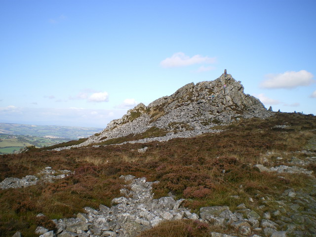
A dramatic rocky spine said to be haunted by the Devil.
Crowned by shattered tors of white quartzite — the Devil's Chair among them — the Stiperstones form an eerie, folklore-haunted ridge with vast views over the Marches.
Official information: Official website not yet identified.
Our tip The path from the Knolls car park is the shortest way to the tors.
Visiting — good to know
The ridge path is rough, rocky and uneven underfoot — a strenuous walk, not accessible.
For blind & low-vision visitors A rough, rocky and uneven ridge with loose quartzite tors and drops — a disorienting, hazardous walk, not suitable for VI visitors without expert guiding.
Sensory A wild, exposed, atmospheric quartzite ridge of wind and folklore - profoundly calm and remote, rarely crowded.
Access last checked 5 Jul 2026 — always confirm with the venue.
Worth watching
- Stiperstones Walk Gone Hiking
More Wikipedia
Wenlock Edge
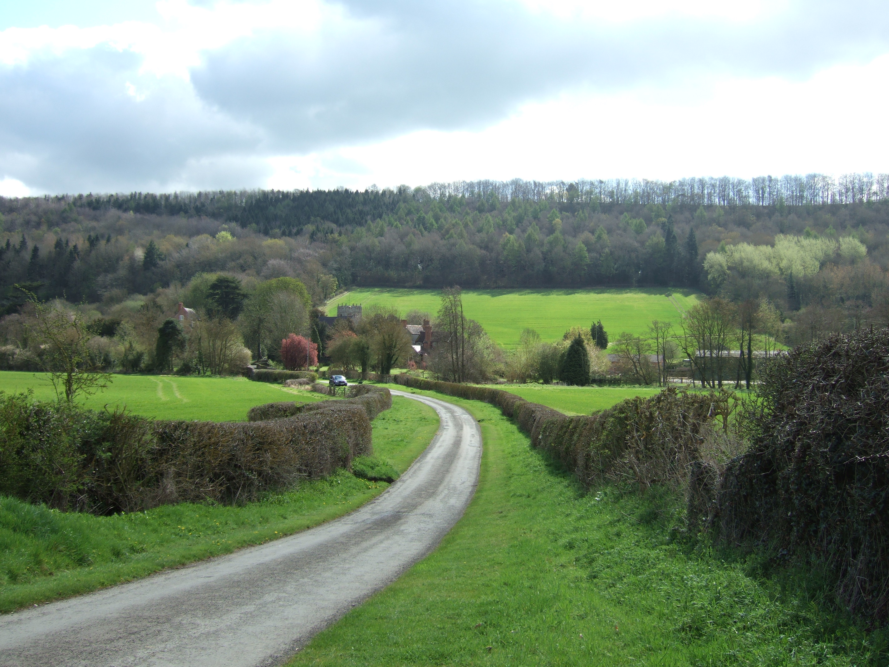
A long, tree-clad ridge of ancient woodland and views.
Immortalised by Housman and Vaughan Williams, Wenlock Edge is a 15-mile wooded limestone escarpment of ancient trees, old quarries and viewpoints looking west to the hills.
Our tip There are several woodland car parks giving short walks onto the Edge.
Memberships and passes
- National Trust — parking included: National Trust members receive free parking at Much Wenlock and Presthope car parks. Official terms (checked 21 Aug 2026)
Visiting — good to know
Woodland trails along the Edge are mostly firm but undulating with some steep sections; parts are unsuitable for wheelchairs.
For blind & low-vision visitors The woodland trails are mostly firm but undulating, with steep drops off the escarpment edge in places — keep to the defined paths, and a guide helps.
Sensory A calm, wooded escarpment of birdsong and wide views - peaceful and immersive, quiet along the Edge.
Access last checked 5 Jul 2026 — always confirm with the venue.
Worth watching
- Sunsets and Exploring Wenlock Edge in Shropshire 4K Walking Tour Brendan Explores
More Wikipedia
Much Wenlock

A timbered town with a priory and Olympic history.
A perfectly preserved little town of black-and-white buildings, Much Wenlock has a romantic ruined priory and, remarkably, gave rise to the modern Olympic Games through Dr William Penny Brookes.
Official information: Official website not yet identified.
Our tip Follow the Olympian Trail around the town's Games history.
Visiting — good to know
The compact town centre is fairly level and walkable; the priory ruins sit on mostly level grass with firm paths.
For blind & low-vision visitors The compact town centre is fairly level and walkable, and the priory ruins sit on level grass with firm paths guided by low walls.
Sensory A calm, pretty timbered town - gently busy, unhurried, with the peaceful priory ruins nearby.
Access last checked 5 Jul 2026 — always confirm with the venue.
Worth watching
- Much Wenlock 🇬🇧 Historic Market Town - Shropshire Walking Tour P4 (2026) 4K Places & Stories With Trinh & Jon
- WENLOCK PRIORY | Discovering SHROPSHIRE'S Monastic GEM Pinned on Places
More Wikipedia
Clun
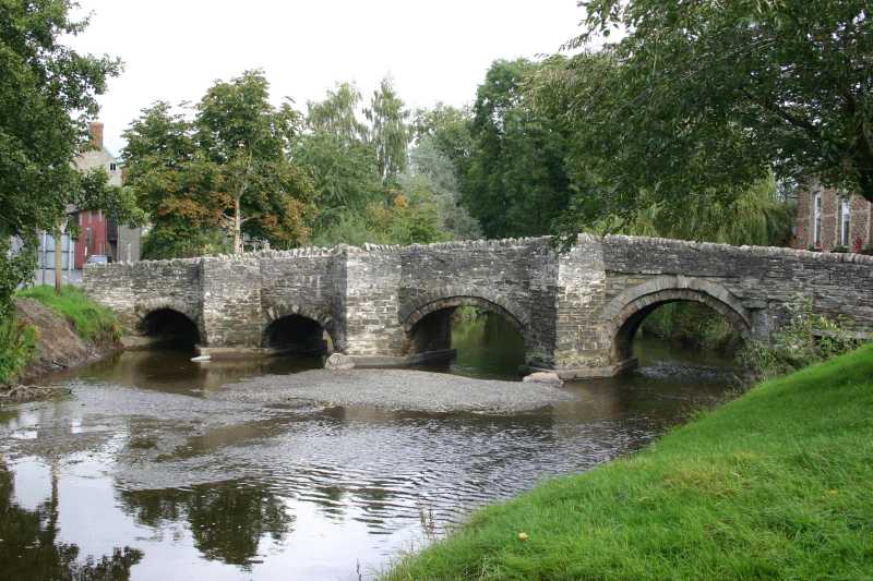
A remote village with a Norman castle by a river.
Deep in the south-west hills, sleepy Clun gathers around a ruined Norman castle above its river and packhorse bridge — a place of Housman's poetry and genuine Marches remoteness.
Our tip The castle earthworks give a fine view over the valley.
Visiting — good to know
The village and riverside are fairly level; the castle sits on a steep grassy mound reached by a climb.
For blind & low-vision visitors The village and riverside are fairly level, but the castle is a steep grassy mound with unfenced earthwork drops — a guide is needed to reach it.
Sensory A calm, remote, sleepy village of birdsong and river - profoundly peaceful and quiet.
Access last checked 5 Jul 2026 — always confirm with the venue.
Worth watching
- Clun Castle | Clun, Shropshire, England. Walking with Bill
More Wikipedia
Bishop's Castle

A steep, quirky town of old pubs and independent shops.
One of the smallest and most characterful of the Marches towns, Bishop's Castle climbs a steep main street of independent shops, old coaching inns and its own brewery to a church at the top.
Our tip The town's two historic breweries are part of its charm.
Visiting — good to know
The town is built on a steep hill with a demanding main street — challenging for wheelchair users, with limited level areas.
For blind & low-vision visitors Built on a steep hill with a demanding main street and few level stretches — tiring and disorienting; the shops and breweries make useful audible landmarks.
Sensory A calm, quirky, independent hill town of old pubs and breweries - gently busy, characterful, unhurried.
Access last checked 5 Jul 2026 — always confirm with the venue.
Worth watching
- This MEDIEVAL ENGLISH TOWN Turned Into An Artist's Dream Hub Kirsten & Joerg: 2 Germans in Britain
- Bishops Castle | Shropshire, England. Walking with Bill
More Wikipedia
Ludlow and the South
The food-lover's town beneath its castle, the timbered manor of Stokesay, riverside Bridgnorth and the Severn Valley Railway.
Ludlow

A handsome Marches town crowned by a great medieval castle.
Often called the loveliest town in England, Ludlow crowns a hill above the River Teme with a mighty medieval castle, five hundred listed buildings and a proud reputation as a food capital.
Our tip The town centre and market are a joy; the castle interior involves steps.
Visiting — good to know
The town centre streets are historic and gently sloping with some cobbles; the castle has uneven ground and steps to the towers.
For blind & low-vision visitors The town-centre streets are historic and gently sloping with cobbles; the castle has uneven ground, steps and unguarded drops from the towers — a guide helps inside.
Sensory A calm, gracious food-and-castle town - gently busy in the centre and at food festivals, peaceful by the river and castle.
Access last checked 5 Jul 2026 — always confirm with the venue.
Worth watching
- LUDLOW, SHROPSHIRE Travel Guide - A Day in the Historic Market Town! Winsper's Travel Vids
- Inside Ludlow Castle – More Than You Expect ThaiBrit Couple
More Wikipedia
Stokesay Castle
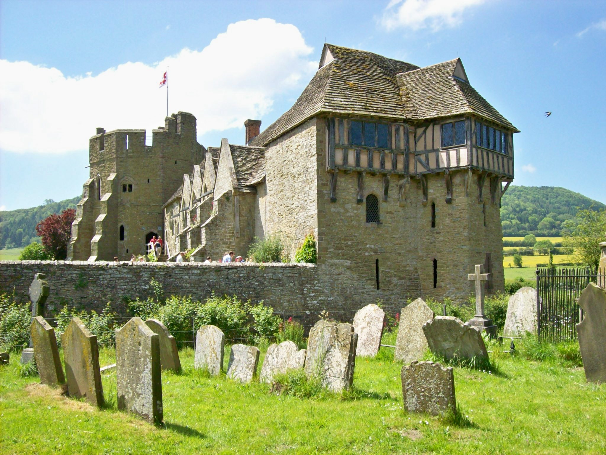
A perfectly preserved 13th-century fortified house.
Not a true castle but a fortified manor house, Stokesay is the best-preserved of its kind in England — a 13th-century hall with a jettied Jacobean gatehouse, barely changed in 700 years.
Our tip The Great Hall's medieval roof is the star; the gatehouse is enchanting.
Visiting — good to know
The ground-floor Great Hall and courtyard have largely level access; the solar and tower involve stairs.
For blind & low-vision visitors The ground-floor Great Hall and courtyard are largely level and defined, but the solar and tower involve stairs and uneven medieval floors.
Sensory A calm, atmospheric, little-changed fortified manor of birdsong - deeply peaceful and rarely crowded.
Access last checked 5 Jul 2026 — always confirm with the venue.
Worth watching
More Wikipedia
Bridgnorth
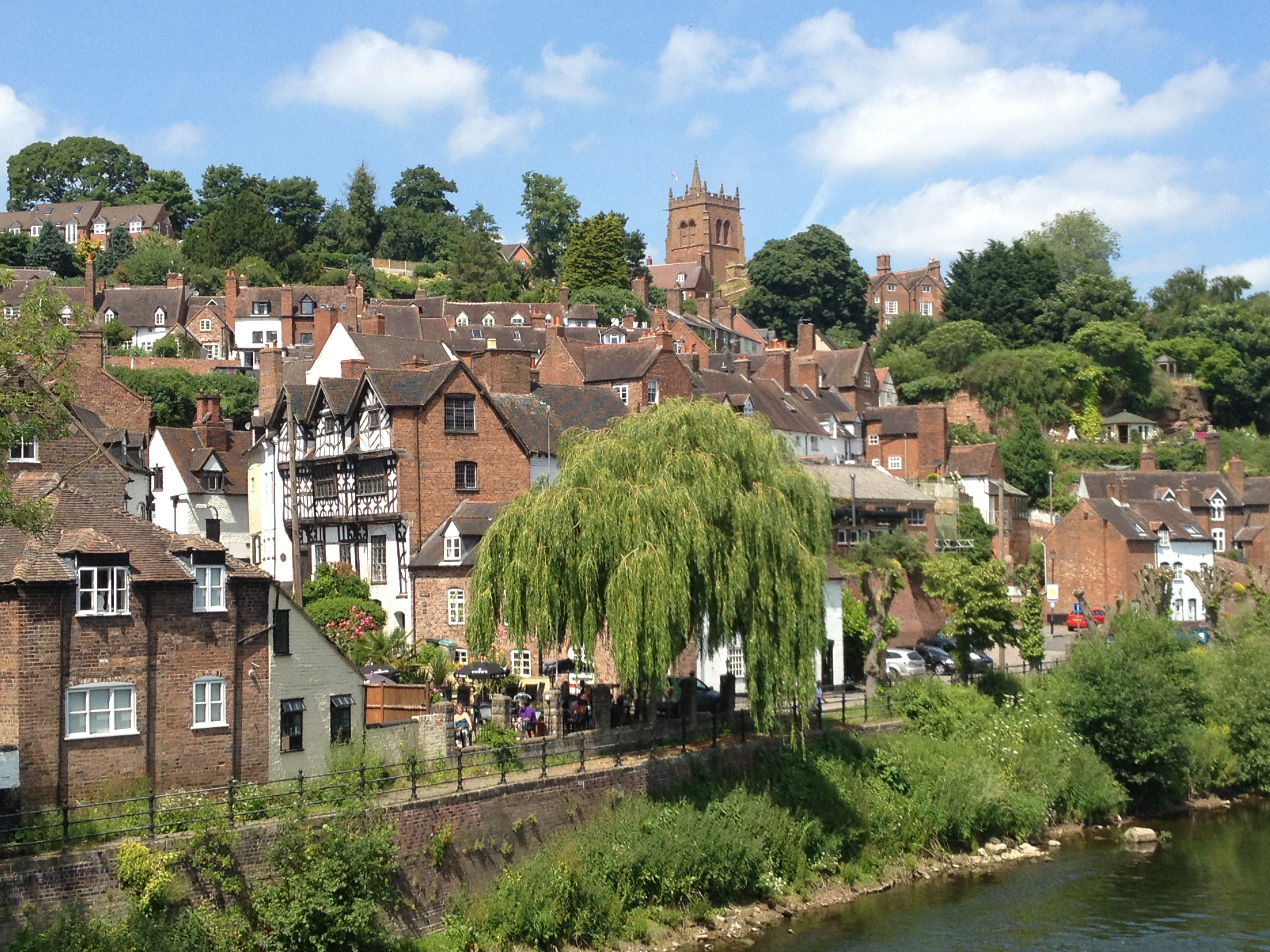
High Town and Low Town linked by England's steepest inland funicular.
Split between a cliff-top High Town and a riverside Low Town, Bridgnorth links the two with the Cliff Railway — England's oldest and steepest inland funicular — and offers wide views over the Severn.
Our tip The Cliff Railway saves the steep climb and is an attraction in itself.
Visiting — good to know
The Cliff Railway offers a step-assisted link between the levels (check its current accessibility); High and Low Town streets are otherwise steep.
For blind & low-vision visitors The Cliff Railway gives a step-assisted, enclosed link between the two towns; otherwise the streets are steep with drops, and the clifftop Castle Walk has open views over a sheer edge.
Sensory A calm, characterful two-level town of cliff railway and wide views - gently busy, peaceful on the clifftop and by the river.
Access last checked 5 Jul 2026 — always confirm with the venue.
Worth watching
- Bridgnorth 🇬🇧 The Most Picturesque River Town - Shropshire Walking Tour P3 (2026) 4K Places & Stories With Trinh & Jon
More Wikipedia
Severn Valley Railway

A 16-mile heritage line of steam trains beside the river.
One of Britain's premier heritage railways, the Severn Valley runs full-size steam trains for 16 scenic miles along the river between Bridgnorth and Kidderminster, through stations frozen in the 1940s.
Our tip Book an accessible carriage space in advance for the smoothest trip.
Visiting — good to know
The railway has wheelchair-accessible carriages and level station access at the main stations — book the accessible space ahead; some smaller halts have steps.
For blind & low-vision visitors Stations have level access and staff assistance and the trains give strong audible cues — mind the platform edge and gap, and book assistance ahead.
Sensory A charming steam railway along the Severn - the sights, sounds and smell of steam, busy with families and on galas.
Access last checked 5 Jul 2026 — always confirm with the venue.
Worth watching
- That Model Railway Guy VISITS: The Severn Valley Railway! That Model Railway Guy
- THE SEVERN VALLEY RAILWAY Travel Guide - Our Day on the UK's Best Steam Railway Winsper's Travel Vids
More Wikipedia
RAF Museum Midlands (Cosford)

Hangars of historic aircraft, from Spitfires to the Cold War.
One of the finest aviation collections in the country and free to enter, Cosford fills huge hangars with over 70 aircraft — wartime fighters, giant bombers and a dramatic Cold War exhibition.
Our tip The Cold War hangar is a spectacular, fully accessible highlight.
Visiting — good to know
The museum is large, level and fully accessible throughout, with step-free hangars, accessible toilets and parking — one of the region's most accessible days out.
For blind & low-vision visitors Large, level and fully step-free throughout, with wide, clear routes and audible, spacious hangars — one of the easier venues to navigate; some aircraft can be touched on request, so ask about handling and audio.
Sensory A large modern museum that can be busy with school groups and has some immersive audio galleries; quieter corners throughout, and free.
Access last checked 5 Jul 2026 — always confirm with the venue.
Worth watching
- RAF Cosford Museum Full Tour 2026 This AMAZING Midlands Attraction Is FREE! ✈️ Adventures With Hayden & Simon
More Wikipedia
Before you go
Shropshire is one of England's least-crowded counties, which is much of its charm, but the Ironbridge museums and Ludlow reward a little planning — the gorge has ten separate museums on one "passport" ticket, so pick your favourites. Read each site's access note: the museums and parks are often well set up, while the hills are open, uneven country. And if you'd like to build a trip around a few, open the planner and shape it around how you travel — with your own access needs applied throughout.