Victoria has thought harder about accessible travel than almost anywhere, and this guide reflects it: every venue here carries the full five-category picture — mobility, blind and low-vision orientation, vision services, sensory environment, and D/deaf and hard-of-hearing provision — each honestly sourced and dated. It runs the whole state, region by region, from the step-free boardwalks above the Twelve Apostles to the goldrush towns, the wine country, the islands and, now, the High Country and the far north. Wherever the data says a place is easy, or hard, or somewhere in between, we say so plainly.
This is the "whole accessible state" companion. For a focused drive, see our dedicated accessible Great Ocean Road route and accessible Melbourne long weekend. Access details change and boarding arrangements for boats and tours vary, so always confirm with the operator before you travel — and note the newest regions have full access notes but photographs are still being added. This guide grows as Victoria does.
The Great Ocean Road
The world-famous coast — much of its finest scenery reached by step-free boardwalks. (For the drive itself, see the 3-day route guide.)
The Twelve Apostles

A cluster of golden limestone sea stacks rising from the Southern Ocean, the icon of the Great Ocean Road.
The Twelve Apostles are the signature sight of the whole coast — great pillars of golden limestone standing offshore where the cliffs of Port Campbell National Park are gnawed away by the Southern Ocean. Boardwalk lookouts from the visitor centre give the classic views, unforgettable at sunrise and sunset. There were never quite twelve, and the sea keeps claiming them.
Our tip Reach the lookouts step-free from the car park via the underpass; the Gibson Steps to the beach are steep.
Visiting — good to know
Partial wheelchair access Accessible parking Accessible toilets Assistance dogs welcome
Sealed, step-free boardwalks from the car park to the main lookouts via an underpass beneath the road; the separate Gibson Steps to the beach are a steep staircase.
For blind & low-vision visitors Boardwalk lookouts have firm, largely level access to clifftop viewpoints — accessible to reach — but they overlook sheer sea-cliffs; keep to the railed lookouts.
Sensory A dramatic, exposed, windswept clifftop, often very busy with tour coaches, with wind and crashing surf; quieter (and best-lit) at dawn and dusk.
Access last checked 6 Jul 2026 — always confirm with the venue.
Worth watching
- Great Accessible Road Trip Part 3: 12 Apostles Helicopters Visit Great Ocean Road
- All abilities access at Loch Ard Gorge and the Twelve Apostles Parks Victoria
More Wikipedia
Also featured in The accessible Great Ocean Road and beyond
Loch Ard Gorge

A sheltered gorge and beach named after the 1878 wreck of the Loch Ard, moments from the Twelve Apostles.
A short way along from the Apostles, Loch Ard Gorge tells the coast's shipwreck history — named for the clipper wrecked here in 1878, from which only two teenagers survived. A network of lookouts rings the caves, blowhole and hidden beach, with interpretive walks explaining the disaster and the fragile cliffs.
Official information: Official website not yet identified.
Our tip Several lookouts are step-free from the car park; the stairs down to the beach are steep.
Visiting — good to know
Partial wheelchair access Accessible parking Accessible toilets Assistance dogs welcome
Sealed paths to clifftop lookouts near the car park; beach access is by steep steps.
For blind & low-vision visitors Clifftop paths and lookouts are largely firm, but steps descend to the beach and the cliff edges are sheer — keep to the railed viewpoints without a guide.
Sensory A dramatic gorge with crashing surf and wind — exposed and elemental; busy at the main lookouts, quieter on the loop paths.
Access last checked 6 Jul 2026 — always confirm with the venue.
Worth watching
More Wikipedia
Also featured in The accessible Great Ocean Road and beyond
Great Ocean Road Memorial Arch

A commemorative timber archway over the road at Eastern View, honouring the returned soldiers who built it.
The Great Ocean Road is the world's largest war memorial, built by some 3,000 returned First World War servicemen between 1919 and 1932 to honour their fallen comrades. The timber Memorial Arch at Eastern View marks the achievement, with a statue of the diggers who carved the road out of the cliffs by hand. A fitting, moving photo stop.
Our tip There's a car park and level viewing area beside the arch.
Visiting — good to know
Partial wheelchair access Accessible parking Assistance dogs welcome
Level, sealed viewing area and car park beside the arch.
For blind & low-vision visitors A roadside memorial arch with a small, largely level viewing area — a brief, open stop with passing traffic and coastal wind.
Sensory A brief roadside photo stop that can be busy with coaches, with passing traffic and sea air; open and quick.
Access last checked 6 Jul 2026 — always confirm with the venue.
Worth watching
- Great Accessible Road Trip Visit Great Ocean Road
- The Great Ocean Road Memorial Arch Alexander Moller
More Wikipedia
Lorne

A relaxed surf-coast resort town of cafes and a gentle beach, backed by the Otway forest and waterfalls.
Lorne has drawn holidaymakers for over a century — a curve of safe swimming beach, a laid-back main street of cafes and galleries, and the forested Otway ranges rising behind, laced with waterfall walks such as Erskine Falls. It's the natural overnight stop midway along the coast.
Official information: Official website not yet identified.
Our tip A flat foreshore and main street; the beach has a sealed promenade above the sand.
Visiting — good to know
Partial wheelchair access Accessible parking Accessible toilets Assistance dogs welcome
Level main street and foreshore promenade; the beach is soft sand.
For blind & low-vision visitors A relaxed coastal town with a level foreshore and beach promenade — fairly easy to follow — with the open beach alongside; the town has gentle slopes.
Sensory A laid-back seaside town, busy in summer holidays, calmer off-season; gentle surf and town bustle.
Access last checked 6 Jul 2026 — always confirm with the venue.
Worth watching
- Lorne Victoria Australia | Weekend Getaway Vlog | Travel With Ryan & Claire Ryan & Claire's World of Fun
- Travel Vlog: Exploring the Beauty of Lorne, Victoria, Australia Aisha Wilson
More Wikipedia
Also featured in The accessible Great Ocean Road and beyond
Apollo Bay

A crescent-bay fishing and holiday town, gateway to the Otway rainforest and Cape Otway.
Where the Great Ocean Road leaves the coast to climb into the Otway rainforest, Apollo Bay sits on a long, gentle crescent of sand — a working fishing town with a harbour, a Saturday market and a relaxed strip of eateries. It's the base for Cape Otway, the Otway treetop walk and the Great Otway National Park.
Our tip Flat foreshore and town centre; a good, calmer alternative base to Lorne.
Visiting — good to know
Partial wheelchair access Accessible parking Accessible toilets Assistance dogs welcome
Level foreshore and main street; soft-sand beach.
For blind & low-vision visitors A calm bayside town with a flat foreshore and beach — easy, open and level along the front — with soft sand and open water beyond.
Sensory A quiet, relaxed fishing-and-holiday town — calm and low-key, busier in peak summer; gentle surf and harbour sounds.
Access last checked 6 Jul 2026 — always confirm with the venue.
Worth watching
- Great Accessible Road Trip Part 6: Big4 Apollo Bay Pisces Holiday Park Visit Great Ocean Road
- Great Accessible Road Trip Part 5 - Wildlife Wonders Visit Great Ocean Road
- 🏖️ Explore Apollo Bay Victoria ~ Things to do in and around Apollo Bay Wander Explore Discover
More Wikipedia
Also featured in The accessible Great Ocean Road and beyond
Cape Otway Lightstation

The 1848 lighthouse on a wild cape between rainforest and the Southern Ocean, with koalas often in the roadside trees.
Perched where Bass Strait meets the Southern Ocean, Cape Otway Lightstation (1848) is the oldest surviving lighthouse on the Australian mainland — built to guide immigrant ships through a treacherous strait. You can climb the tower, explore the keepers' cottages and telegraph history, and koalas are often spotted in the manna gums along the approach road.
Official information: Official website not yet identified.
Our tip The grounds are gravel and grass; the tower is reached by a spiral stair.
Visiting — good to know
Partial wheelchair access Accessible parking Accessible toilets Assistance dogs welcome Companion goes free — residents only
Firm gravel and grass paths around the grounds; the tower interior is a steep spiral staircase.
For blind & low-vision visitors A historic lightstation with firm paths to the tower (steep internal stair); the clifftop grounds are open and exposed with sea-cliff drops.
Sensory A remote, windswept clifftop lightstation with wind and sea — calm and elemental, rarely crowded.
Companion concession Companion goes free via the Australian Companion Card (issued to Australian residents with disability); overseas visitors are not eligible for the card - ask the venue directly about any carer concession.
Access last checked 6 Jul 2026 — always confirm with the venue.
Worth watching
More Wikipedia
Split Point Lighthouse

A photogenic 1891 lighthouse above the cliffs at Aireys Inlet, with clifftop lookouts and coastal walks.
The gleaming white tower of Split Point Lighthouse (1891) stands above the cliffs at Aireys Inlet, familiar to a generation as the lighthouse from the children's series 'Round the Twist'. Clifftop lookouts take in Eagle Rock and the surf coast, and short walks link the viewpoints, with tower tours available.
Official information: Official website not yet identified.
Our tip Level clifftop lookout paths near the car park; tower access is by stairs and tour only.
Visiting — good to know
Partial wheelchair access Accessible parking Accessible toilets Assistance dogs welcome
Sealed clifftop lookout paths near the car park; the tower is stairs-only.
For blind & low-vision visitors A clifftop lighthouse with a firm approach path and viewpoints; the tower stair is steep and the cliff edges open — keep to the defined lookouts.
Sensory An exposed, breezy clifftop with sea and wind — calm and scenic, busier around tour times.
Access last checked 6 Jul 2026 — always confirm with the venue.
Worth watching
- Aireys Inlet & Split Point Lighthouse | Drone Footage Australia Four Around The World
- SPLIT POINT LIGHTHOUSE Aireys Inlet, Victoria DashersRandomVideos
More Wikipedia
Also featured in The accessible Great Ocean Road and beyond
Bells Beach

A world-famous surf break near Torquay, host of the longest-running professional surfing contest.
Bells Beach, near Torquay at the start of the Great Ocean Road, is hallowed ground for surfers — home since 1961 to the Rip Curl Pro, the world's longest-running surfing competition, held each Easter. Even when the pros aren't here, the clifftop lookouts over the powerful reef break are a stirring sight, especially on a big swell.
Official information: Official website not yet identified.
Our tip Clifftop viewing platforms are reachable from the car park; the beach is down steps.
Visiting — good to know
Partial wheelchair access Accessible parking Accessible toilets Assistance dogs welcome
Clifftop lookout platforms near the car park; beach access is by stairs.
For blind & low-vision visitors A famous surf beach seen from clifftop lookouts and steps down to the sand; the lookouts are firm but the cliff and beach access are steep and open.
Sensory A wild, exposed surf beach with wind and pounding waves — elemental; busy and charged during surf competitions, calm otherwise.
Access last checked 6 Jul 2026 — always confirm with the venue.
Worth watching
- E1 - TRAVELLING AUSTRALIA - FAMOUS BELLS BEACH Just Brilliant Adventures
- DAY TRIP - BELLS BEACH | Craig Harris Craig Harris
- POV SURFING LEGENDARY BELLS BEACH! (VAN FIT OUT VLOG) Surfing With Noz
More Wikipedia
Port Campbell

A small, friendly seaside town tucked into a rare sheltered bay right in the heart of the Twelve Apostles country.
Port Campbell is a compact coastal village built around one of the few safe swimming inlets on this wild stretch of coast, with a handful of cafes, pubs and shops along a short main street. It makes a natural stopping point between the big limestone landmarks, and the beach here is calm enough for a paddle when the ocean elsewhere is ferocious.
Official information: Official website not yet identified.
Our tip Use it as your lunch and fuel stop between the Twelve Apostles and Bay of Islands rather than backtracking to a bigger town.
Visiting — good to know
Partial wheelchair access Accessible parking Accessible toilets Assistance dogs welcome
A short, mostly level main street with kerbs and some gentle slopes down towards the foreshore; the beach itself is soft sand reached by steps and a ramp in places.
For blind & low-vision visitors The town centre is a simple, largely level street that is easy to follow, but the foreshore leads to an open, unfenced beach and jetty with deep water alongside; a companion is useful near the water's edge and jetty.
Sensory A relaxed small town that gets busy with coach and self-drive visitors in the middle of the day; quieter early morning and evening.
Access last checked 6 Jul 2026 — always confirm with the venue.
More Wikipedia
Bay of Islands

A sweeping coastal reserve where dozens of limestone stacks rise from the sea, usually with far fewer crowds than the famous Apostles.
The Bay of Islands sits at the western end of the Shipwreck Coast, with short boardwalk paths leading to railed lookouts over a scatter of eroded rock islands and stacks. It is one of the last major viewpoints heading west, and its distance from the main hotspots means it is often peaceful even in summer.
Our tip Come here for the golden light and space in late afternoon when the big-name lookouts to the east are at their busiest.
Visiting — good to know
Partial wheelchair access Accessible parking Accessible toilets Assistance dogs welcome
Sealed car park with firm, largely level pathways to the main lookouts; some paths have gentle gradients and there are steps and steeper descents to any beach-level viewpoints.
For blind & low-vision visitors Boardwalk lookouts give firm, mostly level access but overlook sheer sea-cliffs and unfenced edges beyond the railings; keep to the railed platforms and take a guide near any drop.
Sensory An open, exposed and often windy clifftop, but usually calm and uncrowded; the constant wind and surf noise is the main sensory feature.
Access last checked 6 Jul 2026 — always confirm with the venue.
Worth watching
More Wikipedia
Otway Fly Treetop Walk

An elevated steel walkway that carries you 25 metres up into the cool, fern-filled canopy of the Otway rainforest.
The Otway Fly is a ticketed attraction where a long, gently graded steel walkway loops through the treetops, with an optional springboard cantilever and a spiral lookout tower. The circuit runs above tree-ferns and towering myrtle beech, giving a genuinely different perspective on the ancient forest, and a zipline tour is also run on site.
Official information: Official website not yet identified.
Our tip The main treetop walkway is step-free and largely graded, but check the return loop, as the full circuit includes a steeper forest-floor section.
Visiting — good to know
Partial wheelchair access Accessible parking Accessible toilets Assistance dogs welcome
The elevated steel walkway is graded and mostly gentle, but it is high above the forest floor and gently bounces; the lookout tower and lower forest loop involve stairs and steeper gradients.
For blind & low-vision visitors The walkway is well defined with continuous railings but sits high in the canopy with open sides and long drops below; the surface is steel mesh underfoot, and a guide is helpful on the tower's spiral stairs.
Sensory A cool, shaded, damp rainforest that is calm and quiet outside peak coach times; the height and springy walkway can feel exposed for those uneasy with heights.
Access last checked 6 Jul 2026 — always confirm with the venue.
Worth watching
- Zip Lining at Otway Fly Treetop Adventures - Otway Ranges - Victoria Australia - Great Ocean Road Billy Vollman
- A trip to Otway treetop walk in Victoria|Zipline and many more fun things to do|Must visit!!! Prasad’s Kitchen
- Otway Treetop Walk - A must do in Victoria Australia Distant Lands Travel Store
More Wikipedia
Erskine Falls

A graceful 30-metre waterfall plunging into a fern gully in the hills behind Lorne.
Erskine Falls is one of the best-known waterfalls in the Otways, set in lush temperate rainforest a short drive up from Lorne. An upper viewing platform gives a view of the falls after a short walk, while a longer, much steeper stepped path descends to the base pool.
Official information: Official website not yet identified.
Our tip The upper lookout is reached by a short path with steps; only attempt the long staircase to the base if you are steady on many uneven steps.
Visiting — good to know
Not step-free Assistance dogs welcome
A sealed car park leads to a short but stepped path to the upper viewpoint; reaching the base involves a long, steep staircase of many uneven steps and can be slippery when wet.
For blind & low-vision visitors The path is enclosed by forest with steps and handrails in places, but there are steep drops into the gully off the edge of the track; the constant sound of falling water is a strong audible landmark, and a guide is needed on the steps.
Sensory A cool, damp, shaded fern gully that is peaceful and green; it can be busy at the small car park at weekends and echoes with the noise of the falls.
Access last checked 6 Jul 2026 — always confirm with the venue.
Worth watching
- Hiking Erskine Falls 🌿 Great Otway National Park Waterfall Walk | Victoria, Australia Nature and Places to Go
- Erskine Falls, The Great Ocean Road, Victoria, Australia Shane Nixon
- ERSKINE FALL, LORNE, VIC, Australia Travel Destinations
More Wikipedia
Kennett River Koala Walk
A quiet gravel road through gum forest that is one of the most reliable places to see wild koalas in the trees.
Grey River Road at Kennett River winds up into eucalyptus forest where wild koalas are regularly seen dozing in the branches, and colourful king parrots and rosellas gather near the caravan park. It is a genuinely wild setting rather than a managed sanctuary, so sightings depend on patience and looking up into the canopy.
Official information: Official website not yet identified.
Our tip Walk slowly and scan the forks of the gum trees; early morning and late afternoon are the best times for active koalas.
Visiting — good to know
Partial wheelchair access Accessible toilets
Koalas can often be seen from the flat sealed area near the caravan park and shop; going further means an unsealed, gently climbing gravel road with no footpath, shared with slow-moving cars.
For blind & low-vision visitors This is a road-based walk with no defined path edge and passing vehicles, and the koalas are high in the canopy rather than at ground level; a sighted companion greatly helps for both spotting animals and road safety.
Sensory A calm, leafy forest road; the loud calls of parrots and the occasional passing car are the main sounds, and it can get busy with wildlife-watchers mid-morning.
Access last checked 6 Jul 2026 — always confirm with the venue.
Worth watching
- Kennett River Koala Walk Melbourne Playgrounds
- [4K] Kennett River Nature Walk - Koalas - Walking Tour - Great Ocean Road - Victoria, Australia Walk with us
More Wikipedia
Torquay & the Surf Coast

The bustling seaside town where the Great Ocean Road begins, home to famous surf beaches and Australia's surfing heritage.
Torquay is a busy, well-serviced coastal town at the eastern start of the Great Ocean Road, with wide surf beaches, a promenade, the National Surfing Museum and a large surf-brand retail precinct. World-famous Bells Beach lies just to the south, and the calmer town beaches make it a practical family base before the road turns wild.
Official information: Official website not yet identified.
Our tip Fill up on fuel, food and supplies here — it is the last big, fully equipped town before the coastal stretch becomes remote.
Visiting — good to know
Partial wheelchair access Accessible parking Accessible toilets Assistance dogs welcome
Level footpaths through the town and a sealed foreshore promenade; the beaches themselves are soft sand reached by steps or ramps, and a beach wheelchair may be available in season.
For blind & low-vision visitors The town streets and promenade are largely level and easy to follow, but the beachfront opens onto unfenced sand and surf with strong currents; keep a companion near the water and dune edges.
Sensory A lively, sometimes crowded holiday town, especially in summer and during surf events; the promenade is calmer early in the day and out of season.
Access last checked 6 Jul 2026 — always confirm with the venue.
Worth watching
- Torquay, Surf Coast - Victoria, Australia Walking Tour | 4K 60FPS 🇦🇺 Aussie Jetsetter
- Torquay and Lorne Beach | Victoria | Australia (HD) Little Oz Traveller
- Torquay, Victoria, Australia | Coastal Destination Video Ocean.Observer
More Wikipedia
Maits Rest Rainforest Walk

A gentle boardwalk loop through a cool, mossy gully of giant tree-ferns and towering myrtle beech.
Maits Rest is a short, well-made rainforest circuit in the Great Otway National Park, mostly on boardwalk and gravel through some of the region's most atmospheric old-growth forest. The easy loop takes around half an hour and passes enormous ancient trees, making it one of the most accessible rainforest experiences on the coast.
Our tip It is one of the gentlest forest walks in the Otways, but the boardwalk still has some steps and slopes, so take it slowly in wet weather.
Visiting — good to know
Partial wheelchair access Accessible parking Accessible toilets Assistance dogs welcome
A short loop mostly on boardwalk and gravel with gentle gradients, but it includes some steps and sloped ramps and can be slippery and damp; not a fully level circuit throughout.
For blind & low-vision visitors The boardwalk gives a well-defined edge underfoot for much of the loop, with some railed sections above a fern gully; the constant drip and birdsong of the forest are helpful landmarks, and a guide helps on the stepped parts.
Sensory A cool, dim, hushed rainforest that feels calm and enclosed; usually quiet, with birdsong and running water rather than crowds.
Access last checked 6 Jul 2026 — always confirm with the venue.
Worth watching
- Maits Rest - Otway Rainforest Sightseeing Tours Australia
- Maits Rest Walk, Great Ocean Road, Victoria, Australia George Mackley
- MAITS REST RAINFOREST WALK // Great Otway National Park Nigel Walks
More Wikipedia
Gibson Steps

A steep staircase carved into the cliff that takes you down onto the beach beneath the towering Twelve Apostles cliffs.
Gibson Steps, just east of the main Twelve Apostles centre, offers both a clifftop lookout and a dramatic descent down a steep set of steps to the beach at the base of the 70-metre cliffs. From the sand you can look up at two large limestone stacks, but the beach is wild, unpatrolled and subject to dangerous tides.
Official information: Official website not yet identified.
Our tip You can enjoy the whole scene from the clifftop lookout without the steps; only go down to the beach if the steps are open and the tide is safe.
Visiting — good to know
Not step-free Accessible parking Assistance dogs welcome
A short firm path leads to a clifftop viewpoint, but reaching the beach means a long, steep and exposed staircase cut into the cliff; the beach below is soft sand with no accessible route. Car park and clifftop viewing area are at road level; reaching the beach means the steep Gibson Steps staircase, which is not step-free.
For blind & low-vision visitors The clifftop viewpoint has firm footing but overlooks sheer, largely unfenced sea-cliffs; the descent is steep with open sides and drops, and the beach has fast-rising tides and open water, so a guide is essential beyond the lookout.
Sensory An exposed, windswept clifftop and roaring beach that can feel overwhelming in strong weather; often busy at the top, quieter early and late.
Access last checked 6 Jul 2026 — always confirm with the venue.
Worth watching
- GIBSON’S STEPS ReNz_waNderlust 🇦🇺
- 12 Best Stops On The Great Ocean Road | Victoria, Australia Nat & Don Going Somewhere
More Wikipedia
London Arch (London Bridge)

A striking offshore rock arch, once joined to the mainland until its landward span collapsed in 1990.
London Arch, long known as London Bridge, is a much-photographed limestone formation reached by a short walk to railed clifftop lookouts. It was once a walk-out double arch until the inner span suddenly fell away, stranding two visitors on the far side who had to be rescued by helicopter.
Official information: Official website not yet identified.
Our tip The lookouts are close to the car park and give the best view; there is no safe way down to the water, so enjoy it from the railed platforms.
Visiting — good to know
Partial wheelchair access Accessible parking Accessible toilets Assistance dogs welcome
A sealed car park with short, firm and largely level paths to the main railed lookouts; some viewing points involve gentle slopes and a few steps.
For blind & low-vision visitors Boardwalk lookouts give firm, largely level access but they overlook sheer sea-cliffs; keep to the railed lookouts and take a guide near any unfenced edge.
Sensory A dramatic, exposed, windswept clifftop, often busy with coaches; quieter at dawn and dusk.
Access last checked 6 Jul 2026 — always confirm with the venue.
Worth watching
- TWELVE APOSTLES | LONDON BRIDGE | PART III | VICTORIA, AUSTRALIA | bamgsgv Bridgette Guban
- London Bridge, Great Ocean Rd Victoria, Australia filmed with the DJI Mavic Anthony Smith
- The Arch and London Bridge by Drone AdventurousPair
More Wikipedia
The Grotto
An unusual sinkhole formation where a rock archway frames a calm rock pool with the ocean beyond.
The Grotto is a distinctive coastal feature that is part cave, part blowhole and part rock pool, reached by a walkway and a set of steps down to a viewing deck. From the lower platform you look through an eroded archway to the sea, with a still pool in the foreground that reflects the light.
Official information: Official website not yet identified.
Our tip There is a good view from the upper level, but the full effect is from the lower deck, which is down a flight of steps.
Visiting — good to know
Partial wheelchair access Accessible parking Assistance dogs welcome
A firm path leads from the car park to an upper viewpoint, but reaching the main grotto deck involves a flight of steps that can be uneven and damp.
For blind & low-vision visitors The upper path is reasonably defined, but the steps down are open to sheer coastal drops and the lower deck sits beside deep rock pools and surging water; keep to the railed platform and use a guide on the steps.
Sensory An exposed clifftop with the boom and spray of the sea below; often quieter than the big-name stops, and calmest early or late in the day.
Access last checked 6 Jul 2026 — always confirm with the venue.
Worth watching
- THE GROTTO WALK - Great Ocean Drive - Victoria - Australia Parsh.Photography
- The Grotto, Great Ocean Road, Vic, Australia 🇦🇺 💙 Walk with Audrey
- The Grotto @ Great Ocean Road (The most popular place for couple photo) Walk with Audrey
Teddy's Lookout
An elevated lookout above Lorne where you can watch the St George River curve down to meet the ocean and the Great Ocean Road wind along the coast.
Teddy's Lookout sits in the hills above Lorne, with a short path from the car park to railed viewing platforms. The classic view takes in the mouth of the St George River, a hairpin of the Great Ocean Road hugging the cliffs, and the open sea beyond.
Official information: Official website not yet identified.
Our tip The upper platform is only a short walk from the car park and gives the best-known view; a lower path drops to a second viewpoint via steps.
Visiting — good to know
Partial wheelchair access Accessible parking Accessible toilets Assistance dogs welcome
A short, mostly firm path from the car park to the upper railed platform with gentle slopes; the lower viewpoint is reached by a steeper path and steps.
For blind & low-vision visitors The upper lookout gives firm, largely level access but overlooks steep, forested clifftops and drops to the road and river below; keep to the railed platform and take a guide on the lower stepped path.
Sensory An open, elevated clifftop lookout that is usually calm and uncrowded, with birdsong, wind and distant surf; busier at peak times but rarely overwhelming.
Access last checked 6 Jul 2026 — always confirm with the venue.
Worth watching
The Goldfields
The grand boom towns of the 1850s gold rush — Ballarat, Bendigo and the spa country.
Sovereign Hill

A large open-air museum recreating a Ballarat goldfields township, where you can pan for real gold.
Sovereign Hill brings the 1850s gold rush to life across a whole recreated township — costumed diggers and shopkeepers, a working mine you can descend, candle-makers and coach rides, redcoat soldiers, and a creek where you really can pan for flecks of gold. The evening 'Aura' sound-and-light show tells the story of the Eureka rebellion. Budget most of a day.
Our tip The site is a working goldfield — sloping, unsealed streets and gravel; check the accessible-route map at entry.
Visiting — good to know
Partial wheelchair access Accessible parking Accessible toilets Assistance dogs welcome Companion goes free — residents only
A recreated goldfield on a slope, with unsealed, uneven streets and gravel underfoot; some steep sections.
For blind & low-vision visitors A recreated goldfields town of gravel streets, wooden boardwalks and working machinery — uneven underfoot and busy, but strongly tactile and audible; a guide helps.
Vision services Costumed characters give strong verbal narration and there are hands-on, tactile activities across the site (check the programme).
Sensory A lively, immersive living-history town with costumed characters, gunfire demonstrations (sudden bangs), machinery and crowds — sensory-rich and can be loud.
For D/deaf & hard-of-hearing Auslan and accessible tours run on some days (confirm the current programme).
Companion concession Companion goes free via the Australian Companion Card (issued to Australian residents with disability); overseas visitors are not eligible for the card - ask the venue directly about any carer concession.
Access last checked 6 Jul 2026 — always confirm with the venue.
Worth watching
- Visiting Sovereign Hill! | Awesome Australian Gold Rush Village | Ballarat, VIC 🇦🇺 Theme Park Ogre
- Welcome to Sovereign Hill Sovereign Hill Education
More Wikipedia
Also featured in The accessible Great Ocean Road and beyond
Ballarat

Victoria's largest inland city, rich in Victorian architecture, home to the Art Gallery of Ballarat and Lake Wendouree.
Gold made Ballarat, and the wealth shows in broad boulevards of ornate Victorian buildings, the flag of the 1854 Eureka rebellion (kept at the Eureka Centre), and the Art Gallery of Ballarat — the oldest and one of the finest regional galleries in Australia. Lake Wendouree and its botanic gardens give a gentle, flat lakeside stroll.
Our tip The gallery is free and step-free; the flat Lake Wendouree loop is an easy walk or wheel.
Visiting — good to know
Partial wheelchair access Accessible parking Accessible toilets Assistance dogs welcome
Level city footpaths and a flat, sealed lakeside path at Lake Wendouree; the art gallery is step-free.
For blind & low-vision visitors A grand goldfields city with wide, largely level streets and heritage buildings — navigable — with the usual city traffic crossings.
Sensory A spacious heritage city — generally calm, with everyday bustle; the wide streets and gardens are open and unhurried.
Access last checked 6 Jul 2026 — always confirm with the venue.
Worth watching
- how to use a V/Line train as a wheelchair user Sam Towne 2002
- Discover an accessible Ballarat Visit Ballarat
More Wikipedia
Also featured in The accessible Great Ocean Road and beyond
Bendigo

A handsome goldfields city of ornate architecture, a talking heritage tram, a deep gold mine and Chinese heritage.
Bendigo wears its gold wealth in soaring architecture — the Alexandra Fountain, grand banks and the Sacred Heart Cathedral. You can descend the Central Deborah Gold Mine, ride a vintage talking tram between the sights, and meet the ceremonial dragons of the Golden Dragon Museum, a legacy of the Chinese who came for the gold. A rich, walkable day.
Our tip The heritage tram links the main attractions; the city centre is flat and easy underfoot.
Visiting — good to know
Partial wheelchair access Accessible parking Accessible toilets Assistance dogs welcome
Level city-centre footpaths; the underground mine tour involves a cage descent and is not step-free.
For blind & low-vision visitors An elegant goldfields city with wide, largely level central streets and a heritage tram; the centre is fairly navigable with city traffic.
Sensory A calm, handsome heritage city with unhurried streets and gardens — everyday bustle rather than crowds.
Access last checked 6 Jul 2026 — always confirm with the venue.
Worth watching
- Bendigo Town Guide | Getaway 2020 Getaway
- Top 10 Things to Do in BENDIGO, Australia in 2026 | Ultimate BendigoTravel Guide Oz and Beyond Travel Series
- Top 10 Places to Visit in Bendigo Nathan Sawaya
More Wikipedia
Also featured in The accessible Great Ocean Road and beyond
Bendigo Art Gallery

One of Australia's oldest and largest regional galleries, known for major touring fashion and art exhibitions.
Founded in 1887, Bendigo Art Gallery pairs a strong Australian collection with a national reputation for ambitious touring exhibitions — often blockbuster fashion and design shows that draw visitors from across the country. General entry is free, the spaces are handsome, and it anchors a cultured afternoon in the city.
Our tip Step-free and lift-served; major exhibitions are ticketed while the collection is free.
Visiting — good to know
Step-free / wheelchair access Accessible parking Accessible toilets Hearing loop Assistance dogs welcome
Level, step-free galleries served by lifts.
For blind & low-vision visitors A regional gallery with level entry, lifts and clear, calm routes — a navigable, composed space, busier during major exhibitions.
Vision services Audio-described and tactile tours and large-print materials for blind and low-vision visitors (check the programme).
Sensory A calm, quiet regional gallery — a low-stimulation space, busier during blockbuster shows.
For D/deaf & hard-of-hearing Auslan tours on some days and assistive listening at events (confirm current provision).
Access last checked 6 Jul 2026 — always confirm with the venue.
Worth watching
- Bendigo Art Gallery | Discover Australia’s Premier Regional Art Destination Travel Beauty
- #travel Australia | Bendigo Art Gallery | Victoria Lokimylittledapplesausage.Succus.Travel
- 🏛️ Bendigo Top 10 Things to Do ~ Discover Victoria Wander Explore Discover
More Wikipedia
Daylesford & Hepburn Springs

Twin spa villages in the central highlands, famous for mineral springs, bathhouses, produce and a lake.
The neighbouring villages of Daylesford and Hepburn Springs sit on Australia's greatest concentration of natural mineral springs, and have been a spa and wellness retreat for over a century. Between the historic bathhouse, the produce and cafes, Lake Daylesford and the mineral-spring reserve where you can pump your own sparkling water, it's a restorative, unhurried stop.
Official information: Official website not yet identified.
Our tip Lake Daylesford has a gentle foreshore path; the mineral springs reserve has sealed paths and hand pumps.
Visiting — good to know
Partial wheelchair access Accessible parking Accessible toilets Assistance dogs welcome
Gentle sealed foreshore path at Lake Daylesford; the springs reserve has firm paths with some slopes.
For blind & low-vision visitors A spa town of gentle hills with a lakeside foreshore path (fairly level) and bathhouses reached with some steps; the mineral springs area is uneven.
Sensory A relaxed, restorative spa town — calm and unhurried, busier on weekends; the bathhouses are hushed and warm.
Access last checked 6 Jul 2026 — always confirm with the venue.
Worth watching
- Daylesford & Hepburn Springs | Victoria Little Oz Traveller
- Our Weekend Trip to Daylesford, Victoria! 2-day Itinerary to Daylesford, Regional Victoria Luxuriously Stylish
- Daylesford: The Secret Spa Town Just 90 Minutes From Melbourne Let's Go
More Wikipedia
Also featured in The accessible Great Ocean Road and beyond
Ballarat Wildlife Park

A privately run wildlife park where kangaroos roam free among the paths and keeper talks run through the day.
A family-focused wildlife park on the edge of Ballarat, home to kangaroos, koalas, wombats, crocodiles and a reptile house. Much of the site is a walk-through park with free-roaming kangaroos, alongside enclosures and scheduled keeper presentations. It is a managed, ticketed attraction with sealed and gravel paths across gently undulating ground.
Our tip Arrive for the scheduled keeper talks and feeds, which are timetabled through the day at the entrance.
Visiting — good to know
Partial wheelchair access Accessible parking Accessible toilets Companion goes free — residents only
A mix of sealed and compacted-gravel paths over gently undulating parkland; some sections are grassy or uneven, and a few enclosure viewing points involve short slopes.
For blind & low-vision visitors Paths are mostly well-defined but free-roaming kangaroos may cross your route unexpectedly, and there is a crocodile pond and reptile areas behind barriers. A sighted companion is helpful for spotting animals and navigating the open grassy sections.
Sensory An open-air park that can be busy and noisy in school holidays, especially around feed times; quieter early on weekday mornings, with plenty of open space to step away from crowds.
Companion concession Companion goes free via the Australian Companion Card (issued to Australian residents with disability); overseas visitors are not eligible for the card - ask the venue directly about any carer concession.
Access last checked 6 Jul 2026 — always confirm with the venue.
Worth watching
- ballarat wildlife park EatPlayandStay
- BALLARAT WILDLIFE PARK / AUSTRALIAN ANIMALS / THINGS TO DO IN BALLARAT / VANLIFE / KOALA / KANGAROO Kingdeano Adventures
More Wikipedia
Central Deborah Gold Mine

A preserved 1930s quartz-reef gold mine where you descend by cage lift into genuine underground tunnels.
A historic Bendigo gold mine offering guided underground tours that take you down a working shaft into the rock tunnels where miners once worked. Above ground there is a poppet head, machinery, exhibits and a cafe. The underground tours involve a cage lift, hard hats and walking through narrow, low, uneven mine workings, so they are physically demanding.
Official information: Official website not yet identified.
Our tip Book the underground tour ahead and wear sturdy footwear; the surface displays and cafe are worth seeing even if you skip going down.
Visiting — good to know
Partial wheelchair access Accessible parking Accessible toilets Assistance dogs welcome Companion goes free — residents only
The surface site and cafe are largely level and step-free, but the underground mine is reached by a cage lift and involves narrow, low, uneven rock passages with wet patches and confined spaces — not suitable for wheelchairs or limited mobility.
For blind & low-vision visitors Underground the passages are dark, low and uneven with unfenced edges and machinery, and a guide leads the group throughout; a sighted companion is strongly advised below ground. The surface displays are more open but include heavy machinery and open pit-head structures to keep clear of.
Sensory The underground tour is enclosed, dark and echoey with confined tunnels that some visitors find claustrophobic; the surface site is calmer and more open. Tours run in small groups, so crowding is limited.
Companion concession Companion goes free via the Australian Companion Card (issued to Australian residents with disability); overseas visitors are not eligible for the card - ask the venue directly about any carer concession.
Access last checked 6 Jul 2026 — always confirm with the venue.
Worth watching
- Central Deborah Mine | Getaway 2020 Getaway
- Explore Bendigo's golden heritage Central Deborah Gold Mine
- Bendigo: Gold Mine & Full Tram Tour SydneyTravel&EventsVlogs
More Wikipedia
Bendigo Tramways

Restored heritage trams that run a talking tour along Bendigo's grand gold-era streets, with a depot and workshop to visit.
A working heritage tramway that operates vintage trams on a circuit through central Bendigo, with a recorded commentary covering the city's gold-rush history. There is also a tram depot with a museum and restoration workshop that can be visited. It is a managed, ticketed heritage attraction with hop-on stops at key sights.
Official information: Official website not yet identified.
Our tip The commentary trams stop at major landmarks, so you can hop off, explore and rejoin a later tram on the same ticket.
Visiting — good to know
Partial wheelchair access Accessible parking Accessible toilets Assistance dogs welcome Companion goes free — residents only
The depot, museum and shop areas are largely level, but the heritage trams themselves have high steps up from the street and no level boarding, so they are difficult for wheelchair users and those with limited mobility.
For blind & low-vision visitors Boarding involves stepping up into the tram from a kerbside stop, and trams share the road with traffic, so care is needed at stops; a companion is useful for the steps and for locating stops. Handrails are fitted at the tram doorways.
Sensory Trams rattle, ring bells and can be busy in peak season, though the recorded commentary is clear; the depot museum is a calmer, contained space. Services are quieter on weekday mornings.
Companion concession Companion goes free via the Australian Companion Card (issued to Australian residents with disability); overseas visitors are not eligible for the card - ask the venue directly about any carer concession.
Access last checked 6 Jul 2026 — always confirm with the venue.
Worth watching
- Bendigo: Gold Mine & Full Tram Tour SydneyTravel&EventsVlogs
- Top 10 Things to Do in BENDIGO, Australia in 2026 | Ultimate BendigoTravel Guide Oz and Beyond Travel Series
- Bendigo Tramways Rob Nicholson
More Wikipedia
Castlemaine

A characterful goldfields town known for its heritage streetscape, art gallery, independent shops and lively arts scene.
A former gold-mining town in central Victoria that has become a hub for artists, makers and food producers, set among preserved 19th-century buildings. Highlights include the Castlemaine Art Museum, the botanical gardens and a walkable centre of cafes, galleries and antique shops. It is a free-to-wander town with a mix of level streets and some slopes.
Official information: Official website not yet identified.
Our tip Base yourself around the main street and the art museum, then explore the independent galleries and cafes on foot.
Visiting — good to know
Partial wheelchair access Accessible parking Accessible toilets Assistance dogs welcome
A mostly walkable town centre with sealed footpaths, though some streets slope and a few older kerbs, thresholds and heritage-building entrances have steps.
For blind & low-vision visitors The main streets are largely well-defined with kerbs and crossings, but some heritage shopfronts have single steps or narrow doorways; a companion helps with unfamiliar crossings and shop entrances. The botanical gardens have firm paths alongside grassed areas.
Sensory A calm country town — gently busy on weekends and during festivals, unhurried on ordinary weekdays, with quiet gardens and side streets to retreat to.
Access last checked 6 Jul 2026 — always confirm with the venue.
Worth watching
More Wikipedia
Maldon

A tiny, remarkably intact goldfields town whose whole main street is a living reminder of the 1850s boom.
A small central Victorian town noted for its exceptionally well-preserved streetscape of verandahed shops, hotels and cottages, once declared a notable historic town. The compact main street offers cafes, antique and craft shops and heritage walks, with a nearby steam railway and old mining sites around the edges. It is a free-to-wander village with a level central street and gentler heritage character.
Official information: Official website not yet identified.
Our tip Pick up a heritage walk leaflet locally and explore the main street on foot; it is small enough to see in a relaxed half-day.
Visiting — good to know
Partial wheelchair access Accessible toilets Assistance dogs welcome
The central main street is largely flat with sealed footpaths, but older kerbs, uneven historic paving and single steps into some verandahed shops mean a few premises are not step-free.
For blind & low-vision visitors The compact main street is easy to follow with a continuous line of shopfronts, though verandah posts, uneven paving and occasional steps need care; a companion is helpful for entering heritage buildings. Traffic is light and slow-moving through the centre.
Sensory A quiet, unhurried village most of the time, busier on weekends and market days; there is plenty of calm and open space, with a gentle, slow pace throughout.
Access last checked 6 Jul 2026 — always confirm with the venue.
Worth watching
- Maldon, Victoria Australia’s Best Preserved Gold Rush Town GHI Travel Adventures
- Maldon Victoria ❤️ Explore Australia's First Notable Town - Aerial Visuals Bendigo Aerial
- Maldon, Victoria – Daytrip to Australia’s First Notable Town Nomad Kath
More Wikipedia
Eureka Centre Ballarat

A modern interpretive museum on the site of the 1854 Eureka Stockade, home to the original Eureka Flag.
A contemporary museum telling the story of the Eureka Stockade rebellion and its place in the story of Australian democracy, built beside the historic battle site. Its centrepiece is the fragile original Eureka Flag, displayed alongside interactive exhibits, and the surrounding parkland includes memorials and gardens. It is a purpose-built, largely single-level cultural venue with full visitor facilities.
Official information: Official website not yet identified.
Our tip Allow time for both the indoor exhibits and the surrounding memorial gardens on the actual stockade site.
Visiting — good to know
Step-free / wheelchair access Accessible parking Accessible toilets Assistance dogs welcome
A modern, largely single-level building with step-free entry, smooth floors and lift or ramp access throughout; the surrounding parkland has firm sealed paths with some gentle grassed slopes.
For blind & low-vision visitors Interior routes are wide, well-lit and step-free, making independent movement easier, though some exhibits are dimmed to protect the flag; staff can assist and a companion helps with the low-light display areas. The outdoor memorial gardens have defined paths alongside open lawn.
Sensory A calm, spacious modern museum that is rarely crowded outside school groups; the flag display is deliberately quiet and low-lit, with the open parkland outside offering a peaceful place to pause.
Access last checked 6 Jul 2026 — always confirm with the venue.
Worth watching
- Eureka Centre - Jenny City of Ballarat
- Walking Eureka Stockade Centre and Gardens, Ballarat, Victoria, Australia Exploring With Craig
More Wikipedia
Yarra Valley and the Dandenongs
Wine country, fern-gully railways and an all-Australian animal sanctuary, close to Melbourne.
Puffing Billy Railway

Australia's favourite steam railway, winding from Belgrave through the Dandenong Ranges' fern forests.
Puffing Billy has puffed through the Dandenong Ranges since 1900 — a narrow-gauge steam railway that curls across a famous timber trestle bridge and through fern-gully forest from Belgrave to Gembrook. Riding in the open carriages is a cherished rite of passage; the line is run largely by volunteers and is a genuine working piece of history.
Our tip A dedicated accessible carriage with wheelchair space runs on services — request it when booking.
Visiting — good to know
Partial wheelchair access Accessible parking Accessible toilets Assistance dogs welcome Companion goes free — residents only
Belgrave and major stations have step-free platforms and an accessible carriage with a ramp; book the wheelchair space ahead.
For blind & low-vision visitors A heritage steam railway with staff assistance and accessible carriages on some services (check ahead); strong steam sounds, whistles and smell — mind the platform edge and gap.
Sensory A characterful steam railway — the sights, sounds and smell of steam are the joy, though whistles are sudden and it is busy with families in season.
For D/deaf & hard-of-hearing An accessible carriage and staff assistance are available on services (book the accessible space ahead); strong steam sounds and sudden whistles.
Companion concession Companion goes free via the Australian Companion Card (issued to Australian residents with disability); overseas visitors are not eligible for the card - ask the venue directly about any carer concession.
Access last checked 6 Jul 2026 — always confirm with the venue.
Worth watching
More Wikipedia
Also featured in The accessible Great Ocean Road and beyond
Healesville Sanctuary

A bushland zoo devoted to Australian animals — koalas, platypus, wombats and a birds-of-prey show.
Set in bushland in the Yarra Valley, Healesville Sanctuary specialises in Australia's own wildlife, seen along shady forest trails: koalas and kangaroos, a platypus in its own darkened stream, dingoes, wombats and a stirring free-flight birds-of-prey presentation. It's a national leader in wildlife care and a gentle, immersive family day.
Our tip The main loop is sealed and mostly gentle; a good, calmer alternative to a big-city zoo.
Visiting — good to know
Step-free / wheelchair access Accessible parking Accessible toilets Companion goes free — residents only
Sealed, mostly gentle looped pathway through bushland; a few slopes.
For blind & low-vision visitors A wildlife sanctuary with firm, largely level bush paths and strong animal sounds and smells as cues — fairly navigable — in a natural, wooded setting.
Vision services A strongly sensory bush-and-birdsong experience; keeper talks give verbal detail (check the programme).
Sensory A calm, natural bush sanctuary of birdsong and native animals — peaceful and immersive, busier in school holidays.
For D/deaf & hard-of-hearing Some Auslan and accessible programmes run on selected days (confirm current provision).
Companion concession Companion goes free via the Australian Companion Card (issued to Australian residents with disability); overseas visitors are not eligible for the card - ask the venue directly about any carer concession.
Access last checked 6 Jul 2026 — always confirm with the venue.
Worth watching
- Virtual Tour of Healesville Sanctuary Zoos Victoria
- HEALESVILLE SANCTUARY - MUST VISIT PLACE IN VICTORIA, AUSTRALIA Blair Villanueva
More Wikipedia
Also featured in The accessible Great Ocean Road and beyond
Dandenong Ranges (Sherbrooke Forest)

Cool fern-gully forest of giant mountain-ash and lyrebirds on Melbourne's eastern skyline, laced with walking tracks.
The Dandenong Ranges rise green on Melbourne's eastern horizon, their slopes cloaked in tall mountain-ash and tree-fern gullies. Sherbrooke Forest and the wider parklands offer everything from short strolls to the famous 1000 Steps Kokoda Track memorial walk, with superb lyrebirds, rosellas and cool air. Grand gardens and tea rooms dot the hilltop villages.
Official information: Official website not yet identified.
Our tip Tracks range from sealed and gentle to steep and rough; check Parks Victoria for step-free options like Alfred Nicholas Gardens' sealed paths.
Visiting — good to know
Partial wheelchair access Accessible parking Accessible toilets Assistance dogs welcome
Forest tracks vary widely — some sealed and gentle, many natural, steep or stepped (the 1000 Steps is a long stair climb).
For blind & low-vision visitors Cool, fern-filled forest with some firm trails (like the Rainforest Gallery boardwalk) but many steep, uneven, rooty paths; strong scent, birdsong and lyrebird calls.
Sensory A calm, cool, green mountain forest of tree ferns, birdsong and lyrebirds — peaceful and immersive; busier at the popular hubs.
Access last checked 6 Jul 2026 — always confirm with the venue.
Worth watching
More Wikipedia
SkyHigh Mount Dandenong
A hilltop lookout, garden and bistro on the summit of Mount Dandenong, overlooking the whole city and bay.
From the highest point of the Dandenongs, SkyHigh gives a sweeping outlook over Melbourne, Port Phillip Bay and out to the You Yangs — spectacular by day and after dark when the city lights spread below. There's a bistro, an English-style garden, a maze and easy lookout paths, making it a relaxed finish to a day in the ranges.
Official information: Official website not yet identified.
Our tip The main lookout terrace is sealed and step-free; entry is a small per-car fee.
Visiting — good to know
Step-free / wheelchair access Accessible parking Accessible toilets Assistance dogs welcome
Sealed, step-free lookout terrace and garden paths near the car park; some sloped sections.
For blind & low-vision visitors A hilltop lookout with a firm, largely level viewing terrace and garden; open views over Melbourne, with some exposed edges.
Sensory A calm hilltop lookout and garden — peaceful, busier at sunset and for dining; open and breezy.
Access last checked 6 Jul 2026 — always confirm with the venue.
Worth watching
- SkyHigh Mount Dandenong Tour Passage Pioneer
- SkyHigh Mount Dandenong, Victoria, Melbourne Walkthrough & Tour Melbish
More Wikipedia
Yarra Valley Wineries

Australia's oldest cool-climate wine region, an hour from the city, known for pinot noir, chardonnay and sparkling.
The Yarra Valley, an hour east of Melbourne, is one of Australia's most acclaimed cool-climate wine regions — rolling vineyards producing elegant pinot noir, chardonnay and sparkling, with cellar doors ranging from grand estates to tiny family growers. Add the TarraWarra art museum, chocolate and cheese makers and hot-air balloons at dawn, and it's a rich day out.
Our tip Many cellar doors have step-free tasting rooms; use a wine-tour driver so no one has to abstain.
Visiting — good to know
Partial wheelchair access Accessible parking Accessible toilets Assistance dogs welcome
Varies by estate; larger cellar doors typically have step-free tasting rooms and accessible parking.
For blind & low-vision visitors Cellar doors vary — many have level tasting rooms and terraces among the vines; the grounds are open, sometimes uneven, in rural surroundings.
Sensory A calm, rural wine country of vineyards and rolling hills — relaxed and unhurried, busier at weekend cellar doors.
Access last checked 6 Jul 2026 — always confirm with the venue.
Worth watching
More Wikipedia
Also featured in The accessible Great Ocean Road and beyond
William Ricketts Sanctuary
A shaded mountain-ash and tree-fern gully studded with clay sculptures of Aboriginal figures, set into rocks and mossy banks.
This Parks Victoria sanctuary in the Dandenong Ranges holds more than ninety kiln-fired clay sculptures made by potter William Ricketts, blending human faces with the forest. It is a quiet, reflective place rather than a big attraction, with a network of narrow paths winding through damp, ferny bushland.
Official information: Official website not yet identified.
Our tip Go on a still, overcast morning when the ferns drip and the crowds are thin; the light and quiet are the whole point.
Visiting — good to know
Partial wheelchair access Accessible parking Accessible toilets Assistance dogs welcome
Sloping bush paths of packed earth, stone and steps wind down through the gully; some upper areas near the entrance and car park are firmer and more level, but lower sections are steep, uneven and can be slippery when wet.
For blind & low-vision visitors A network of narrow, twisting paths with tree roots, low rock edges and unrailed drops into the fern gully; the sculptures sit at varying heights among rocks and are easy to walk into. Damp stone and moss make footing unpredictable. A sighted guide is strongly advised, and it helps to move slowly and touch nothing without checking.
Sensory A deeply quiet, enclosed forest space with birdsong, running water and deep shade; it can feel intense and contemplative rather than calming for some. Quietest early on weekdays and busiest on fine weekends.
Access last checked 6 Jul 2026 — always confirm with the venue.
Worth watching
Alfred Nicholas Memorial Gardens
A terraced hillside garden of exotic trees, rhododendrons and ferns dropping to an ornamental lake with a small timber boathouse.
Laid out in the 1930s on a steep Sherbrooke hillside, these gardens are best known for the postcard view of a wooden boathouse mirrored in a still lake at the bottom of the valley. Paths descend through cool-climate plantings and towering mountain ash, with the display strongest in spring and again in autumn colour.
Official information: Official website not yet identified.
Our tip The boathouse is at the very bottom of the garden, so plan for a steady uphill climb back to the car park at the end.
Visiting — good to know
Partial wheelchair access Accessible parking Accessible toilets Assistance dogs welcome
Sealed and gravel paths, but the garden falls steeply down a hillside with long slopes and some steps; the upper terraces near the entrance are the most manageable, while the lake and boathouse involve a sustained descent and climb.
For blind & low-vision visitors Paths curve downhill with changing surfaces, sloping edges and an unfenced ornamental lake at the base — the water's edge and low banks are a real hazard in low vision. A sighted guide is advised for the descent, and extra care is needed anywhere near the lake and boathouse.
Sensory A calm, green, open-air garden with birdsong and rustling canopy; gently busy on fine spring and autumn weekends, quiet and unhurried on weekday mornings.
Access last checked 6 Jul 2026 — always confirm with the venue.
Worth watching
TarraWarra Museum of Art
A low, curving architect-designed gallery set among Yarra Valley vines, showing modern and contemporary Australian art.
TarraWarra is a purpose-built regional art museum on a working wine estate near Healesville, holding a significant collection of post-war Australian painting alongside changing exhibitions. The building itself is a calm, single-level space of concrete and rammed earth, with wide gallery rooms and views out over the valley.
Our tip Check opening days before you set out — the museum closes on Mondays and between exhibitions, so it is not an every-day drop-in.
Visiting — good to know
Step-free / wheelchair access Accessible parking Accessible toilets Assistance dogs welcome
A modern, largely single-level building with smooth firm floors, level or gently ramped internal circulation and step-free access from the car park; the surrounding grounds are grassed and undulating.
For blind & low-vision visitors Interior galleries are open, evenly lit and step-free with clear sightlines, making self-guided movement fairly predictable; artworks are wall-hung and generally not to be touched. The approach from the gravel car park and any outdoor sculpture areas are less defined, so a guide is useful for the grounds.
Sensory A quiet, controlled indoor gallery atmosphere with soft acoustics and low crowds on weekdays; busier at exhibition openings and on fine weekends when it is paired with a winery visit.
Access last checked 6 Jul 2026 — always confirm with the venue.
Worth watching
- About TarraWarra Museum of Art TarraWarra Museum of Art
- TarraWarra Museum of Art Ted's Camera Stores
- About TarraWarra Museum of Art TarraWarra Museum of Art
More Wikipedia
Cloudehill Gardens
A series of formal garden 'rooms' stepping down a Dandenongs hillside, with a nursery and a well-regarded cafe.
Cloudehill is a privately created ornamental garden at Olinda, laid out as linked outdoor rooms with clipped hedges, herbaceous borders, mature trees and mountain views. It is a ticketed garden with an on-site nursery and the Seasons restaurant, popular for a combined garden-and-lunch outing.
Official information: Official website not yet identified.
Our tip Time a visit for late spring or autumn, and book the cafe ahead on weekends, when the garden and restaurant are at their busiest.
Visiting — good to know
Partial wheelchair access Accessible parking Accessible toilets Assistance dogs welcome
Gravel and grass paths on a terraced hillside with steps between several garden rooms and some steady slopes; the cafe, nursery and upper terraces are the most level, while lower parts of the garden need step and slope navigation.
For blind & low-vision visitors Paths change between gravel, paving and lawn, with steps and hedge-lined edges dividing the garden rooms and occasional low retaining walls; levels shift often, so a sighted guide helps for the terraced sections. There is no open water hazard, but the changing surfaces and steps warrant care.
Sensory A tranquil, structured garden with birdsong and hedged, sheltered spaces; gently busy at the cafe on weekends and quiet on weekday mornings.
Access last checked 6 Jul 2026 — always confirm with the venue.
Worth watching
- Visit Cloudehill Gardens thediggersclub
- Cloudehill Garden & Plant Nursery Walking Tour Olinda Dandenong Ranges Melbourne Victoria Australia Walking and Sightseeing Travel Channel
- Cloudehill Gardens jesse tanmoya
Yarra Valley Chocolaterie

A large chocolate maker and ice-creamery near Yarra Glen, with viewing windows, tastings, a cafe and landscaped grounds.
This is a big, purpose-built chocolate destination where you can watch chocolatiers at work through glass, sample free tastings and buy from a huge retail counter. Entry is free, and there is a busy cafe, ice-cream window and gardens with valley views, making it a popular family and coach stop.
Our tip Weekends and school holidays get very crowded and the car park fills fast, so arrive early or aim for a weekday.
Visiting — good to know
Step-free / wheelchair access Accessible parking Accessible toilets Assistance dogs welcome
A modern single-level building with smooth firm flooring and step-free access from the car park; the surrounding grounds are gently sloping lawn and paved paths.
For blind & low-vision visitors Indoor retail and cafe areas are open and well lit but can be crowded, with people, queues and free-standing display tables to navigate, so movement is easier with a guide when busy. The outdoor grounds slope gently and have lawn edges rather than hard hazards.
Sensory A bright, lively, high-traffic space with strong aromas, chatter and echoing hard surfaces; it can be loud and busy on weekends and holidays, and much calmer on weekday mornings soon after opening.
Access last checked 6 Jul 2026 — always confirm with the venue.
Worth watching
- Yarra Valley Chocolaterie — Victoria, Australia | HD Travel Tour
- 4K Walking Tour of the Yarra Valley Chocolaterie Gardens – Yarra Glen, Australia- Part 1 CouchWalks - 4K Walking Tours from your Couch
- 4K Walking Tour of the Yarra Valley Chocolaterie Gardens – Yarra Glen, Australia- Part 2 CouchWalks - 4K Walking Tours from your Couch
More Wikipedia
Mornington Peninsula and Phillip Island
Bayside towns, hot springs, and the nightly penguin parade.
Phillip Island Penguin Parade

The nightly parade of the world's smallest penguins coming home across the beach at Summerland, watched from boardwalks.
Every evening at dusk on Phillip Island, hundreds of little penguins — the world's smallest — surf ashore and waddle up the beach to their burrows, one of Australia's great wildlife spectacles. A modern eco visitor centre and tiered boardwalks let you watch without disturbing them; the island also has koalas, seals at the Nobbies and Churchill Island's heritage farm.
Official information: Official website not yet identified.
Our tip The main viewing has step-free boardwalk positions and accessible viewing — book these ahead; bring warm layers.
Visiting — good to know
Partial wheelchair access Accessible parking Accessible toilets Companion goes free — residents only
Step-free boardwalks and accessible viewing areas at the visitor centre; exposed and cold after dark, dress warmly.
For blind & low-vision visitors Firm, level boardwalks and tiered viewing (some steps); the experience is chiefly the sound and presence of penguins at dusk — a guide helps with the tiered seating in low light.
Vision services The parade is chiefly a sound-and-presence experience of penguins at dusk in low light; commentary describes the scene (check accessible viewing).
Sensory A dusk wildlife spectacle, often crowded and cool, with the sounds of penguins and sea; hushed viewing but busy stands — lighting is deliberately dim.
For D/deaf & hard-of-hearing Accessible viewing areas and assistive provision; the commentary is the main audio (confirm current provision).
Companion concession Companion goes free via the Australian Companion Card (issued to Australian residents with disability); overseas visitors are not eligible for the card - ask the venue directly about any carer concession.
Access last checked 6 Jul 2026 — always confirm with the venue.
Worth watching
More Wikipedia
Also featured in The accessible Great Ocean Road and beyond
Sorrento & Portsea

Genteel limestone resort villages at the end of the Mornington Peninsula, with calm bay beaches and a ferry to Queenscliff.
At the tip of the Mornington Peninsula, Sorrento and Portsea are the peninsula's most polished villages — 19th-century limestone buildings, a main street of cafes and boutiques, and a choice of calm 'front' bay beaches and wilder 'back' ocean beaches. A car-and-passenger ferry crosses the heads to Queenscliff, and dolphin and seal swims run from the pier.
Official information: Official website not yet identified.
Our tip The Sorrento front beach and foreshore are gentle; ocean 'back' beaches involve steps and surf.
Visiting — good to know
Partial wheelchair access Accessible parking Accessible toilets Assistance dogs welcome
Level main street and bay-side foreshore; ocean beaches are reached by steps.
For blind & low-vision visitors Genteel bayside towns with foreshore paths and beaches; the fronts are fairly level with open water, while some beaches and back-beach cliffs are steeper.
Sensory Relaxed, upmarket bayside resorts — calm and pleasant, busy in peak summer; gentle bay beaches and sea air.
Access last checked 6 Jul 2026 — always confirm with the venue.
Worth watching
More Wikipedia
Peninsula Hot Springs
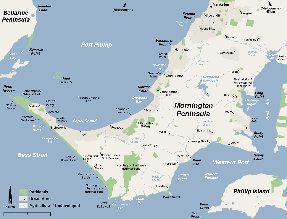
A large geothermal bathing retreat on the Mornington Peninsula, with dozens of mineral pools including a hilltop lookout bath.
Australia's first natural hot-springs bathhouse draws mineral-rich water from deep underground into dozens of pools scattered through landscaped grounds — from cave and reflexology pools to a hilltop lookout bath with peninsula views. There are family-friendly and adults-only precincts, spa treatments and cafes. Deeply relaxing, especially on a cool day.
Official information: Official website not yet identified.
Our tip Accessible pools with hoist and ramp access are available — arrange in advance when booking.
Visiting — good to know
Partial wheelchair access Accessible parking Accessible toilets Companion goes free — residents only
Sealed paths link the pools with some gentle slopes; selected pools offer ramp/hoist access by arrangement.
For blind & low-vision visitors A bathing complex of pools linked by paths and steps, some uneven and wet; warm, steamy and tactile, with staff assistance — the hilltop pool involves a climb.
Sensory A calm, restorative hot-springs retreat of warm water and quiet — a deliberately low-stimulation, soothing environment; busier on weekends.
Companion concession Companion goes free via the Australian Companion Card (issued to Australian residents with disability); overseas visitors are not eligible for the card - ask the venue directly about any carer concession.
Access last checked 6 Jul 2026 — always confirm with the venue.
Worth watching
- Unwinding in the Peninsula Hot Springs | Getaway Getaway
- The Peninsula Hot Springs | Melbourne Road Trip Kale Brock (Kale Brock)
- Explore More Peninsula Hot Springs morningtonpeninsula
More Wikipedia
Cape Schanck Lighthouse

The southern tip of the Mornington Peninsula, with a historic lighthouse, boardwalk lookouts and a rugged coast.
At the peninsula's dramatic southern point, Cape Schanck's white 1859 lighthouse still guides ships past a coast of black basalt and pounding surf. A boardwalk descends towards the rock platform, and clifftop lookouts take in the meeting of Bass Strait and the bay. Part of Mornington Peninsula National Park, with a museum in the keepers' quarters.
Official information: Official website not yet identified.
Our tip The upper lookouts near the car park are step-free; the boardwalk to the point has many steps.
Visiting — good to know
Partial wheelchair access Accessible parking Accessible toilets Assistance dogs welcome Companion goes free — residents only
Sealed viewing areas near the car park and lighthouse; the boardwalk down to the point is a long stepped descent.
For blind & low-vision visitors A clifftop lighthouse with a firm boardwalk to lookouts and a long, steep stair/boardwalk down to the rocks; the cliff edges are open — keep to the railed viewpoints.
Sensory A wild, windswept clifftop with wind and surf — exposed and elemental, calm and uncrowded outside peak times.
Companion concession Companion goes free via the Australian Companion Card (issued to Australian residents with disability); overseas visitors are not eligible for the card - ask the venue directly about any carer concession.
Access last checked 6 Jul 2026 — always confirm with the venue.
Worth watching
- Cape Schanck - Overview & Lighthouse PART 1 - VICTORIA AUSTRALIA 2016 - VIRTUAL TOURIST SERIES Next Level Lens
- Cape Schanck Lighthouse accommodation and tours on the Mornington Peninsula capeschanck
- Cape Schanck Lighthouse - Victoria - Day Trip Ulaa - Explore With My Family
More Wikipedia
Arthurs Seat Eagle

A gentle enclosed gondola glides you up Arthurs Seat to sweeping views over Port Phillip Bay and the Mornington Peninsula.
The Eagle is a modern cable-car (enclosed gondolas) running from a base station near Dromana up to a hilltop summit station on Arthurs Seat. It is a ticketed attraction with cafes, a shop and a viewing terrace at both ends, and it is a genuinely accessible way to reach a high lookout without a climb. On a clear day you can see across the bay to Melbourne.
Official information: Official website not yet identified.
Our tip Go on a clear, still day for the views; wind can pause or close the gondola, so check conditions before setting out.
Visiting — good to know
Step-free / wheelchair access Accessible parking Accessible toilets Assistance dogs welcome Companion goes free — residents only
Sealed, level paths at both the base and summit stations, with lift or step-free access to the boarding platform. Gondolas are enclosed cabins that pause or slow for boarding; staff can hold a cabin for wheelchair users. The summit terrace is paved and largely level.
For blind & low-vision visitors Boarding is a staff-assisted step across a small gap into an enclosed, fully-sided cabin, so there are no open drops on the ride itself. The summit terrace has railed viewing edges above a steep hillside; keep to the paved, railed areas. A companion or staff member is useful for guiding to and from the cabin and for describing the bay view.
Sensory The gondola is quiet and smooth, but the cabin sways gently and rises high, which can unsettle those uneasy with heights or motion. Busiest at weekends, in school holidays and on fine afternoons; early morning is calmer and clearer.
Companion concession Companion goes free via the Australian Companion Card (issued to Australian residents with disability); overseas visitors are not eligible for the card - ask the venue directly about any carer concession.
Access last checked 6 Jul 2026 — always confirm with the venue.
Worth watching
More Wikipedia
Point Nepean National Park

A windswept headland of 19th-century gun forts, a former quarantine station and coastal tracks looking out to the treacherous Rip at the mouth of Port Phillip Bay.
Point Nepean National Park occupies the sandy tip of the Mornington Peninsula, wrapping the historic Quarantine Station and the military fortifications of Fort Nepean. It is a Parks Victoria site with a visitor area, a shuttle option and walking and cycling tracks running out to the point. The forts include tunnels and gun emplacements, and the coast here is exposed and dramatic.
Official information: Official website not yet identified.
Our tip It is a long way out to Fort Nepean; use the park shuttle (the Point Nepean transfer) if walking the full distance is too much, and check its timetable in advance.
Visiting — good to know
Partial wheelchair access Accessible parking Accessible toilets Assistance dogs welcome
The visitor area and Quarantine Station precinct have sealed paths and some step-free heritage buildings, but the route out to Fort Nepean is long, with slopes, gravel sections and steps into the tunnels and gun emplacements. Coastal tracks are uneven in places.
For blind & low-vision visitors Around the historic buildings the ground is firm and defined, but the forts include unfenced or low-railed edges above the sea, dark tunnels, sudden steps and steep drops toward the water — a guide is strongly advised beyond the main precinct. The Rip and open sea are close and unforgiving; do not approach unrailed cliff edges.
Sensory A large, open, exposed headland that is very windy and can feel remote; the tunnels are dark, echoing and enclosed. Generally uncrowded and quiet away from the visitor centre, busier on fine weekends and during holidays.
Access last checked 6 Jul 2026 — always confirm with the venue.
Worth watching
More Wikipedia
Churchill Island Heritage Farm

A gentle island of restored colonial farm buildings, working-farm demonstrations and easy coastal paths, reached by a short bridge near Phillip Island.
Churchill Island is a small island connected by a bridge near Newhaven, run as a heritage farm within the Phillip Island Nature Parks family of attractions. Visitors can see historic homestead buildings and gardens and watch working-farm demonstrations such as sheep-shearing, cow-milking, blacksmithing and working-dog displays. A visitor centre and cafe sit near the entrance, with walking tracks around the shoreline.
Official information: Official website not yet identified.
Our tip Time your visit around the daily farm demonstrations — check the day's programme at the visitor centre when you arrive.
Visiting — good to know
Partial wheelchair access Accessible parking Accessible toilets Companion goes free — residents only
The visitor centre, cafe and core farm precinct have accessible paths, but parts of the farm and the coastal walking tracks are grass, gravel or gently sloping, and some historic buildings have thresholds or steps. Demonstration areas are mostly firm underfoot.
For blind & low-vision visitors Main paths around the visitor precinct are firm and reasonably defined; farm and shoreline areas are more open, with grass, animals, fences and gates to navigate, so a guide helps. The demonstrations are strongly audible landmarks — shearing, animals and the blacksmith give clear points of orientation. Watch for low farm rails and uneven ground away from the sealed paths.
Sensory A calm, rural setting with farm-animal sounds, occasional machinery and the smells of a working farm; crowds gather at demonstration times but disperse in between. Quietest early in the day and outside school holidays.
Companion concession Companion goes free via the Australian Companion Card (issued to Australian residents with disability); overseas visitors are not eligible for the card - ask the venue directly about any carer concession.
Access last checked 6 Jul 2026 — always confirm with the venue.
Worth watching
- Churchill Island Heritage Farm | Things to do in Phillip Island | Victoria, Australia | Travel Guide Amazing Australia
- Churchill Island Heritage Farm Melbourne Playgrounds
More Wikipedia
Koala Conservation Reserve
Treetop boardwalks and bushland trails let you spot koalas dozing in the gum canopy on Phillip Island.
The Koala Conservation Reserve (also known as the Koala Conservation Centre) is a Phillip Island Nature Parks site with raised boardwalks that bring you up to the level of the treetops where wild koalas rest. Ground-level bushland trails wind through the reserve, and a visitor centre explains koala conservation. Koalas are wild and free-moving, so sightings are not guaranteed but are usually good.
Our tip Koalas are most active and easiest to spot in the cooler parts of the day; move slowly and quietly along the boardwalk and look up into the fork of the gum trees.
Visiting — good to know
Step-free / wheelchair access Accessible parking Accessible toilets Companion goes free — residents only
The main elevated boardwalk is a firm, gently graded timber walkway suitable for wheelchairs, with the visitor centre step-free. Some lower bushland trails are gravel or natural surface and may be less even.
For blind & low-vision visitors The raised boardwalk is well defined with continuous edge rails, giving a safe, enclosed route through the trees; the koalas are quiet, so low-vision visitors will usually need a companion or staff to point out an animal in the canopy. Ground trails are firmer to follow underfoot but less clearly edged.
Sensory A calm, hushed bushland reserve where visitors keep noise down for the animals; birdsong and rustling leaves dominate. Rarely crowded, though busier at midday in holidays — early and late visits are quietest and best for koala activity.
Companion concession Companion goes free via the Australian Companion Card (issued to Australian residents with disability); overseas visitors are not eligible for the card - ask the venue directly about any carer concession.
Access last checked 6 Jul 2026 — always confirm with the venue.
Worth watching
- Phillip Island Koala Conservation Reserve & Penguin Parade Adventures with Andrea
- Koala Conservation Reserve, Phillip Island | Places to visit from Melbourne | Australia Travel Guide Amazing Australia
More Wikipedia
Red Hill & Peninsula Wineries

A cluster of cool-climate vineyards, cellar doors and produce stops set among the rolling green hills of the inland Mornington Peninsula.
Red Hill and the surrounding inland peninsula are the heart of the Mornington Peninsula wine region, known for pinot noir and chardonnay. This is an area rather than a single site — a scattering of individual cellar doors, restaurants and produce venues along country lanes, many with hilltop views. Facilities vary widely from venue to venue, from polished modern tasting rooms to small family operations.
Official information: Official website not yet identified.
Our tip Cellar doors are spread across winding rural roads with no footpaths, so plan a driver or a booked wine tour rather than trying to walk between them.
Visiting — good to know
Partial wheelchair access Assistance dogs welcome
This is a dispersed rural wine area; larger, modern cellar doors and restaurants are often step-free with sealed car parks, while smaller venues may have gravel yards, garden steps or sloping approaches. Provision differs at each venue, so check the specific winery before visiting.
For blind & low-vision visitors There is no single defined route; you move by car between venues on narrow country roads without footpaths, so a driver or guide is essential. Within each cellar door, watch for gravel surfaces, garden steps and unmarked edges around vineyard terraces and hilltop decks.
Sensory A quiet, unhurried countryside of vineyards and open hills; individual tasting rooms can be busy and lively at weekends and lunchtimes but calm on weekday mornings. Wide-open, sometimes windy hilltop settings.
Access last checked 6 Jul 2026 — always confirm with the venue.
Worth watching
- Montalto, Red Hill, Mornington Peninsula. Montalto Vineyard
- Red Hill South, Mornington Peninsula Mornington Peninsula Visitor Centre
More Wikipedia
Ashcombe Maze & Lavender Gardens
A tall living hedge maze, a circular lavender labyrinth and formal rose gardens set in peaceful peninsula countryside.
Ashcombe Maze is a ticketed garden attraction near Shoreham, famous for its towering cypress hedge maze — one of Australia's oldest — alongside a lavender labyrinth and an extensive circular rose garden. There is a cafe and gift shop, and paths wind between the different garden areas. It is a landscaped, cultivated setting rather than wild bushland.
Official information: Official website not yet identified.
Our tip The lavender is at its best in the warmer months (roughly December to March); the roses peak in late spring, so time your visit to what you most want to see.
Visiting — good to know
Partial wheelchair access Accessible parking Accessible toilets Assistance dogs welcome Companion goes free — residents only
Garden paths are mostly firm — gravel, grass and some paved sections — and largely level, though the hedge maze has narrow, winding turns and the wider grounds include gentle slopes. The cafe and main areas are step-free or close to it.
For blind & low-vision visitors The formal gardens have defined paths that are reasonable to follow, but the hedge maze is deliberately disorienting, with high, blind-cornered walls of hedge where a companion is essential to avoid getting lost. The lavender and rose gardens offer very strong scent landmarks that aid orientation.
Sensory A calm, fragrant, richly scented garden — lavender and roses are intense in season — with birdsong and open lawns; gently busy on fine weekends and in flowering season, quiet on weekday mornings.
Companion concession Companion goes free via the Australian Companion Card (issued to Australian residents with disability); overseas visitors are not eligible for the card - ask the venue directly about any carer concession.
Access last checked 6 Jul 2026 — always confirm with the venue.
Worth watching
- Ashcombe Maze and Lavender Gardens morningtonpeninsula
- Ashcombe Maze & Lavender Gardens | Australia | Jan 2022 Evie's Tour
The Nobbies & Seal Rocks
Elevated boardwalks wind across a windswept headland at the western tip of Phillip Island, looking out to the offshore Seal Rocks and their fur-seal colony.
The Nobbies is a dramatic coastal headland run by Phillip Island Nature Parks, with a boardwalk circuit over rugged cliffs, blowholes and rocky islets. Offshore lie Seal Rocks, home to one of Australia's largest Australian fur-seal colonies, which can be viewed at a distance (binoculars or the on-site cameras help). There is a visitor centre and cafe (the Nobbies Centre) at the car park.
Official information: Official website not yet identified.
Our tip It is fiercely exposed to the wind here — bring warm, windproof layers even in summer, and use the boardwalk railings.
Visiting — good to know
Partial wheelchair access Accessible parking Accessible toilets
The visitor centre and its immediate surrounds are step-free, and much of the boardwalk is firm timber, but the circuit is steep in places with ramps, steps and stretches that climb and descend across the headland. Strong wind adds to the effort.
For blind & low-vision visitors The boardwalk is edge-railed and defined, but it runs across a high, exposed clifftop above sheer drops to the sea with blowholes and rocky gullies below — keep firmly to the railed walkway and do not stray onto the surrounding heath. The seals are far offshore and hard to see; a companion or the on-site cameras help. Wind noise and salt spray are constant orientation cues.
Sensory A wild, roaring, windswept and often cold headland with crashing surf and strong smells of the sea and seals; it can be busy with coaches by day but is quieter at opening and toward dusk.
Access last checked 6 Jul 2026 — always confirm with the venue.
Worth watching
- The Nobbies and Seal Rocks Paul D-Australia
- Seal Rocks and the Nobbies | Phillip Island | Victoria Australia | DJI Mavic Pro | 4K D&W Cam
- Nobbies Centre Sightseeing Tours Australia
The Grampians and Wilsons Prom
The rugged national parks — ancient rock art, waterfalls and the southern tip of the mainland.
The Grampians (Gariwerd) — Halls Gap

The village at the heart of Grampians National Park, ringed by rugged sandstone peaks, waterfalls and Aboriginal rock-art sites.
Halls Gap nestles in a valley at the centre of the Grampians (Gariwerd), a range of tilted sandstone ridges rising abruptly from the western plains. Kangaroos graze the town oval at dusk; around it lie waterfalls, the sweeping Boroka and Reed lookouts, and some of south-east Australia's most important Aboriginal rock-art shelters, interpreted at the Brambuk cultural centre.
Our tip The village and some lookouts are accessible by road; many walks are steep and rocky — plan around ability.
Visiting — good to know
Partial wheelchair access Accessible parking Accessible toilets Assistance dogs welcome
The village is level; several lookouts have short sealed paths from car parks, but most peak and gorge walks are steep and rough.
For blind & low-vision visitors A mountain-town base with a level main street and some firm valley walks, but the ranges are steep, rocky and exposed with unfenced lookout drops — a guide for the trails.
Sensory A calm, natural mountain setting of bush, birdsong and roaming kangaroos around Halls Gap — peaceful, busier in holidays; the ranges are wild and quiet.
Access last checked 6 Jul 2026 — always confirm with the venue.
Worth watching
- Top 5 Things To Do in The Grampians [Hall's Gap Area] Heckin' Adventurous
- 🦘Explore Halls Gap Victoria ~ Things to do in and around Halls Gap and The Grampians. Wander Explore Discover
- A guide to the Grampians: Top attractions you MUST visit Let's Go
More Wikipedia
MacKenzie Falls
A powerful waterfall plunging into a fern-fringed gorge, one of few in Victoria that flows all year.
MacKenzie Falls is the showpiece of the Grampians — a broad curtain of water tumbling over sandstone ledges into a misty pool, and one of the few Victorian falls that runs strongly year-round. A steep sealed path descends to the base, while the Bluff lookout offers the falls without the climb.
Our tip Parks Victoria says the MacKenzie Falls car park and all walks are closed during the current construction works. Check current conditions before travelling.
Plan your visit
- Opening
- Parks Victoria states that the car park and all MacKenzie Falls walks are closed from 9 February 2026 through the end of 2026 during construction. Recheck the official conditions page before travel.
Visitor information checked 21 Aug 2026. Opening and prices can change.
Access not yet checked — please confirm with the venue before you travel.
Worth watching
Wilsons Promontory (Tidal River)

The southernmost tip of mainland Australia, a wilderness of granite mountains, wildlife and dazzling beaches around Tidal River.
'The Prom' is Victoria's best-loved national park — the southernmost point of the mainland, where granite tors rise over forests, wetlands teeming with wombats and emus, and beaches of blindingly white, squeaky sand. Tidal River is the hub, with the gentle Squeaky Beach nearby and the climb up Mount Oberon for a panoramic reward.
Official information: Official website not yet identified.
Our tip Tidal River has some sealed accessible paths and facilities; most tracks (Squeaky Beach, Mount Oberon) are natural, sandy or steep.
Visiting — good to know
Partial wheelchair access Accessible parking Accessible toilets Assistance dogs welcome
Tidal River hub has some sealed paths and accessible facilities; most walks are natural, sandy, rocky or steep.
For blind & low-vision visitors A remote park with some firm, level boardwalks (around Tidal River) but mostly wild, uneven bush and beach tracks with open water and surf — a guide off the main paths.
Sensory A wild, remote coastal wilderness of birdsong, surf and bush — profoundly calm and natural, busier at Tidal River in summer.
Access last checked 6 Jul 2026 — always confirm with the venue.
Worth watching
More Wikipedia
Mount Buffalo National Park

A high granite plateau in the north-east high country, with dramatic lookouts, a gorge, waterfalls and winter snow.
Mount Buffalo rises as a great granite massif above the Ovens Valley, its plateau strewn with wildflowers in summer and snow in winter. The road climbs to the sheer Gorge lookout and the historic (now closed) chalet, with short walks to tumbling falls, the Cathedral rock formations and views across the high country. Cool, scenic and less crowded than the coast.
Our tip Several lookouts are close to the road; higher walks and the Horn summit are steep and rocky.
Visiting — good to know
Partial wheelchair access Accessible parking Accessible toilets Assistance dogs welcome
Some lookouts are a short walk from the road; many tracks are steep, rocky or stepped, and roads can be snow-affected in winter.
For blind & low-vision visitors A granite plateau park with some firm lookout paths but much steep, rocky, uneven ground and sheer unfenced clifftop drops — keep to the railed lookouts, a guide for trails.
Sensory A high, cool, granite mountain wilderness of wind, birdsong and wide silence — calm and remote, with snow in winter.
Access last checked 6 Jul 2026 — always confirm with the venue.
Worth watching
More Wikipedia
Brambuk Cultural Centre
A striking, curved-roofed centre near Halls Gap where the Grampians' Aboriginal story is told by the traditional owners themselves.
Brambuk is the cultural and visitor hub for the Gariwerd (Grampians) region, run in partnership with local Aboriginal communities to share the area's living heritage, art and Dreaming stories. It houses displays, art and information on the wider national park, and its distinctive building echoes the shape of a cockatoo in flight. Note that provision here has changed over recent years, so opening arrangements can vary.
Official information: Official website not yet identified.
Our tip Combine your visit with the nearby Halls Gap facilities, and check current opening hours before setting out as they have shifted in recent seasons.
Visiting — good to know
Step-free / wheelchair access Accessible parking Accessible toilets Assistance dogs welcome
A purpose-built centre with sealed, largely level approaches, ramped access and smooth interior floors; the surrounding grounds have some gentle garden paths and slopes.
For blind & low-vision visitors Indoor displays are set along defined routes with even flooring, so a low-vision visitor can move around confidently, though the varied lighting and art displays make a companion or guide helpful for the exhibits. Outside, keep to the made paths; the car park and garden edges are unfenced but there are no significant drops.
Sensory A calm, contemplative indoor space with cultural displays; generally quiet, busier in school holidays and around midday. The setting is peaceful with birdsong and open bushland nearby.
Access last checked 6 Jul 2026 — always confirm with the venue.
Worth watching
- Brambuk the National Park and Cultural Centre (Grampians) Australia Australia Australia
- Brambuk - The National Park & Cultural Centre, Victoria Australia About Australia
- Brambuk Cultural Centre West of Melbourne Travel Tips
Squeaky Beach
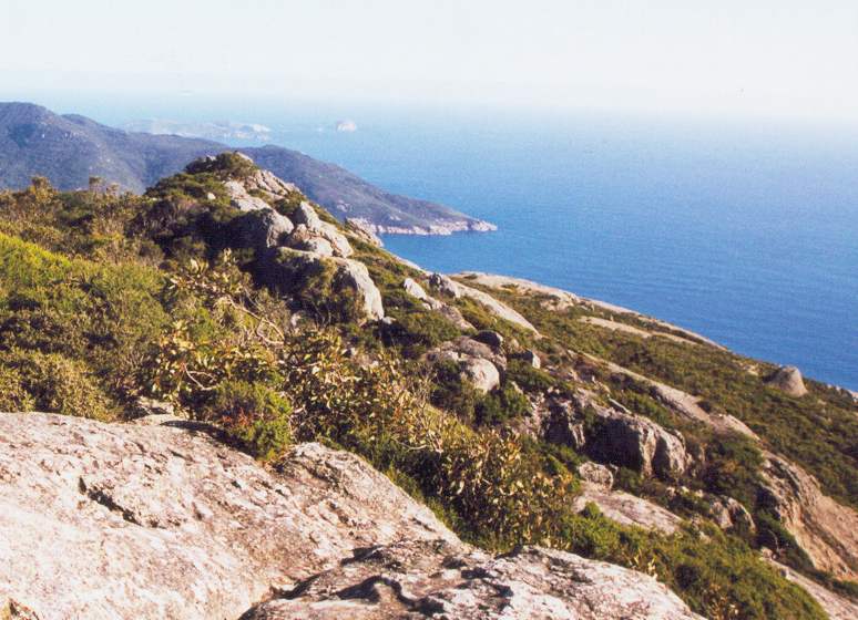
A famous crescent of powder-white quartz sand in Wilsons Promontory that literally squeaks underfoot as you walk.
Squeaky Beach is one of Wilsons Promontory National Park's best-loved beaches, its rounded quartz grains squeaking as you step across them and its shore framed by granite boulders and clear water. It sits a short drive and walk from the Tidal River hub, reached by a track that crosses coastal heath and a footbridge. The water is open ocean with no lifeguards, so swimming carries real risk from currents.
Official information: Official website not yet identified.
Our tip Wear shoes you can slip off, and take great care in the water — there are no patrols and currents can be strong; the sand itself is the main attraction.
Visiting — good to know
Not step-free Accessible parking Assistance dogs welcome
Reached by a natural track from the car park that includes uneven ground, a footbridge and steps down onto the beach; the beach itself is deep, soft sand that is very hard to cross on wheels or with limited mobility.
For blind & low-vision visitors The approach track is a defined but uneven bush path, and the final descent to the sand is not level; a low-vision visitor will want a guide. Once on the beach there is open, unfenced water with no railings or patrols — stay well back from the surf line and treat the sea edge as a real hazard.
Sensory An exposed coastal beach with the constant sound of surf and wind; busy on fine summer days and school holidays, much quieter early morning and out of season. Bright sand can be dazzling in strong sun.
Access last checked 6 Jul 2026 — always confirm with the venue.
Worth watching
More Wikipedia
Mount Oberon Summit
A steady climb to a granite summit with sweeping views over Wilsons Promontory's coast, islands and Tidal River.
The Mount Oberon summit walk is the signature climb of Wilsons Promontory National Park, a roughly 7km return route on a wide management track that gains real height to a rocky top. From the summit boulders you look out over Tidal River, Norman Bay and the surrounding coastline and islands. It is a genuine uphill walk that takes most people two to three hours return, and the final section scrambles over granite.
Official information: Official website not yet identified.
Our tip Start early to beat the heat and crowds, carry water, and turn back at the last safe viewpoint if the granite scramble to the very top feels exposed.
Visiting — good to know
Not step-free Accessible parking Assistance dogs welcome
A long, continuously uphill gravel management track with a sustained gradient, finishing with rock steps and an exposed granite scramble to the summit boulders; not suitable for wheels or for those unsteady on their feet.
For blind & low-vision visitors The track is wide and firm but relentlessly uphill, and the final approach crosses open, unrailed rock with drops beyond the summit boulders — this is a place where a low-vision walker needs a sighted guide and should stop at the last secure viewpoint rather than the rock top. A shuttle serves the car park at the base, which is a safer, level place to enjoy the setting.
Sensory An exposed mountain walk, windy and open near the top; steady foot traffic on fine days, quieter early and in cooler months. The summit is high, breezy and dramatic with big open views.
Access last checked 6 Jul 2026 — always confirm with the venue.
Worth watching
- Mount Oberon Summit - Places to Visit Wilsons Promontory- 4K #camping Punjabi Aussie Traveller
- Mount Oberon Summit Walk-South Gippsland Victoria Australia\Wilsons Promontory Lanie Jumaway
More Wikipedia
The Pinnacle Lookout
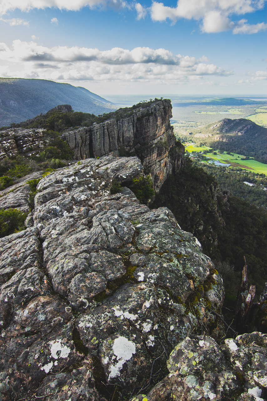
A dramatic rock ledge high above Halls Gap, reached by a rugged walk through the Grampians' sandstone gullies.
The Pinnacle is the Grampians' best-known viewpoint, a jutting rock platform that looks out over the Fyans Valley and Halls Gap far below. Reaching it is a demanding walk through boulder-strewn gullies such as the Grand Canyon, with steps, rock scrambles and narrow passages depending on the route taken. A railing marks the very lookout, but much of the surrounding terrain is exposed clifftop with sheer drops.
Our tip This is a strenuous rocky hike, not a stroll — wear proper footwear, allow several hours, and keep firmly behind the rail at the lookout, where the drop is sheer.
Visiting — good to know
Not step-free Accessible parking Assistance dogs welcome
A rugged mountain walk over rock steps, loose stone, boulder scrambles and narrow gaps with significant elevation gain; there is no step-free or wheeled access to the lookout itself. Parking is at the Wonderland and Sundial trailhead car parks; the lookout itself is reached only by a rocky mountain path and is not step-free.
For blind & low-vision visitors The route is uneven natural rock with scrambles and confined passages, and the final platform sits atop sheer sandstone cliffs with drops just beyond a single railing — a low-vision visitor should not attempt this without an experienced sighted guide and must stay hard against the rail. Treat every unfenced edge here as a fall hazard.
Sensory A high, exposed, windswept clifftop popular with walkers; busiest late morning on fine days, calmer at dawn. The gullies feel enclosed and cool, the summit open and breezy with a strong sense of height.
Access last checked 6 Jul 2026 — always confirm with the venue.
Worth watching
- Hiking the Iconic Pinnacle Lookout | Grampians National Park | Australia Vlog Wandering Zena
- The Pinnacle Walk and Lookout 8K Nature Traveller
- The Pinnacle Walk | Most Popular Walk in the Grampians Worth Seeing?
More Wikipedia
Boroka Lookout
A short, well-made walk to railed platforms with a sweeping outlook over Halls Gap, Lake Bellfield and the ranges.
Boroka Lookout offers one of the Grampians' grandest views for the least effort, reached by a short sealed path from a roadside car park to fenced viewing platforms. From the railed lookouts you gaze over Halls Gap, Lake Bellfield and the surrounding peaks. Because it is drive-to and largely level, it suits visitors who cannot manage the harder summit walks, though the platforms overlook steep cliffs.
Official information: Official website not yet identified.
Our tip This is the easiest way to enjoy a true Grampians panorama — keep to the railed platforms, as the rock beyond them drops away sharply.
Visiting — good to know
Partial wheelchair access Accessible parking Assistance dogs welcome
A short, mostly sealed and largely level path leads from the car park to railed viewing platforms; there may be some gentle gradients and minor uneven sections, but no climbing or scrambling.
For blind & low-vision visitors The made path and railed platforms give firm, largely level access and a defined route, which makes this far more manageable for a low-vision visitor than the summit walks — but the platforms overlook sheer clifftops, so keep to the railed areas and treat any rock beyond the fence as a sheer drop.
Sensory An exposed clifftop lookout that can be windy and bright; popular at sunset and on fine days, quieter at other times. Open, expansive and airy, with a strong sense of height at the platform edge.
Access last checked 6 Jul 2026 — always confirm with the venue.
Worth watching
- Boroka LookOut and The Balconies in Grampians Victoria Australia 🇦🇺🇦🇺 Shine Espere
- Boroka Lookout What's Up Downunder
- Boroka Lookout & Mackenzie Falls | Victoria’s Most EPIC Road Trip Adventure 🇦🇺 Hamza Asghar 🇦🇺
The High Country and the Alps
Victoria's mountains — alpine villages, snow country and the Great Alpine Road.
Bright

A leafy alpine town on the Ovens River, famous for its blazing autumn colours and easy riverside strolls.
Bright is a small mountain town at the foot of the Victorian Alps, best known for the European trees that turn gold and crimson each autumn. A flat, sealed path follows the Ovens River through the centre, linking cafes, an old railway walk and swimming holes, with the higher peaks of Falls Creek and Mount Hotham nearby.
Official information: Official website not yet identified.
Our tip Come in late April and May for the autumn colour; the riverside path is the easiest way to enjoy it without a climb.
Visiting — good to know
Partial wheelchair access Accessible parking Accessible toilets Assistance dogs welcome
A largely level town centre with sealed footpaths; the riverside and old rail-trail paths are flat and firm, though some side streets slope gently and a few cafe entrances have a step.
For blind & low-vision visitors A walkable, mostly level main street and a well-defined sealed riverside path, but the Ovens River runs close by and is unfenced in places, so keep to the centre of the path near the water. A guide is helpful for finding cafe entrances and river crossings.
Sensory A relaxed country town, gently busy in the cafes and much busier during autumn colour season and school holidays; quiet in the mornings and midweek.
Access last checked 6 Jul 2026 — always confirm with the venue.
Worth watching
- Exploring Bright & Victoria's STUNNING High Country Let's Go
- The Exceptionally Beautiful Town Of Bright, Victoria, Australia. Where In The World Is Pierre?
- Bright Victoria Australia | Autumn Colours | Drive And Walk Full Tour Bright & Around 2021 WORLD THE WAY I SEE
More Wikipedia
Beechworth

One of Victoria's best-preserved gold-rush towns, with honey-coloured granite streetscapes and a strong Ned Kelly connection.
Beechworth grew rich in the 1850s gold rush and kept its handsome granite public buildings, courthouse and old gaol almost intact. The main street is a heritage streetscape of shopfronts, a historic bakery and honey shop, and the courthouse where Ned Kelly was committed for trial, all within a compact walkable centre.
Official information: Official website not yet identified.
Our tip Park once and explore the main street on foot; the historic precinct and courthouse are all close together.
Visiting — good to know
Partial wheelchair access Accessible parking Accessible toilets Assistance dogs welcome
The main street is broadly level with sealed footpaths, but many historic buildings have original stone thresholds, single steps at doorways and uneven older paving; some heritage interiors are not step-free.
For blind & low-vision visitors A largely level main street that is easy to follow, but expect uneven kerbs, occasional single steps into shops and older cobbled or flagged surfaces. A guide helps with entrances to the courthouse, gaol and museum buildings.
Sensory A calm, unhurried country town for most of the year, busier on weekends, market days and during festivals; the historic buildings are generally quiet inside.
Access last checked 6 Jul 2026 — always confirm with the venue.
Worth watching
- Town Showcase: Beechworth, Victoria! EVERYTHING YOU NEED TO KNOW! Next Level Adventures
- ⚒️ Explore Beechworth Victoria's High Country ~ Things to do in and around Beechworth Wander Explore Discover
- Beechworth Victoria Australia Walking Tour Exploring Australia
More Wikipedia
Glenrowan (Ned Kelly country)

The small town where the Kelly Gang made its final stand in 1880, now the heart of Ned Kelly tourism.
Glenrowan is a tiny town made famous by the siege of June 1880, where bushranger Ned Kelly was captured in his home-made armour. Today it has a large Kelly statue, siege-site markers around the town, and small privately run attractions and shops telling the story; the actual historic sites are modest and spread along the streets.
Official information: Official website not yet identified.
Our tip The siege-site markers are free to walk between; check opening hours before relying on the small paid attractions, which can be seasonal.
Visiting — good to know
Partial wheelchair access Accessible parking Accessible toilets Assistance dogs welcome
The town is small and mostly flat with sealed footpaths, but some siege-site markers sit on grass or gravel verges, and the small private attractions vary in their step-free access.
For blind & low-vision visitors A level, easy-to-follow main street, but the historic markers are scattered and some stand on unfenced grass or gravel beside the road; a guide or advance planning helps locate them and read the interpretive signs.
Sensory A quiet roadside town most of the time, with occasional coach groups; the small attractions can include sudden sound effects or dramatised displays, so ask staff what to expect.
Access last checked 6 Jul 2026 — always confirm with the venue.
Worth watching
- Ned Kelly Country Glenrowan Australia Two Birds in a Van Australia
- Glenrowan VIC – Kelly Country Highlights Sapphire Blue Travel
- NED KELLY MUSEUM GLENROWAN / NED KELLY / VICTORIAN TOURIST TOWN / NED KELLY HISTORY / NED KELLY GANG Kingdeano Adventures
More Wikipedia
Rutherglen Wine Region
A historic wine region on the Murray plains, celebrated worldwide for its rich fortified muscats and tokays.
Rutherglen is an old gold-and-wine town surrounded by long-established family wineries, many with cellar doors set among vines. It is best known for its intensely sweet fortified muscat and topaque, and the flat, warm country makes for easy touring between tasting rooms and the heritage main street.
Official information: Official website not yet identified.
Our tip Cellar doors are spread across flat farmland, so plan a route and arrange a driver; many welcome visitors for tastings without booking, but confirm ahead.
Visiting — good to know
Partial wheelchair access Accessible parking Accessible toilets Assistance dogs welcome
The town and country are flat, and larger cellar doors typically have level or ramped entry and firm paths, but some smaller or older wineries have gravel yards, steps or uneven ground between the car park and tasting room.
For blind & low-vision visitors The main street is level and walkable; at wineries, surfaces range from sealed to loose gravel and the layout of vineyard cellar doors varies, so a guide or a phone call ahead helps with orientation and step-free routes.
Sensory A relaxed rural wine district, generally quiet, busier during the region's food-and-wine festival weekends; tasting rooms are usually calm and unhurried.
Access last checked 6 Jul 2026 — always confirm with the venue.
Worth watching
- Rutherglen - Travel guide and things to do, Victoria Starring AnnaToy
- Rutherglen (VIC) – Victoria’s Hidden Wine & Heritage Gem Arrows To Australia
More Wikipedia
Milawa Gourmet Region

A small gourmet district clustered around cheese, mustard, wine and honey producers in the King Valley foothills.
Milawa is a tiny rural locality that has become a hub for artisan food, with a well-known cheese factory, a mustard and condiment shop, wineries and a bakery all close together. It makes an easy, flat food trail, with tasting counters and farm-gate shops rather than grand attractions.
Official information: Official website not yet identified.
Our tip The main producers are within a short drive of each other on level ground, making it one of the easiest gourmet trails to do in an afternoon.
Visiting — good to know
Partial wheelchair access Accessible parking Accessible toilets Assistance dogs welcome
The area is flat and the main producers generally have level or ramped entry and firm floors, though car parks and a few farm-gate shops have gravel or a threshold step.
For blind & low-vision visitors Flat, open ground between producers, but they sit apart along rural roads rather than a single walkable street, so getting between them needs a vehicle; a guide helps with tasting counters and gravel yards.
Sensory A quiet rural food district; the cheese factory and shops can be gently busy at weekends and holidays but are otherwise calm.
Access last checked 6 Jul 2026 — always confirm with the venue.
Worth watching
- Discover Milawa: A Gourmet Journey through Victoria's Culinary Heart Visit Wangaratta
- Discover the Milawa Gourmet Region Milawa Gourmet
More Wikipedia
Falls Creek Alpine Resort

A high-altitude alpine resort village, a ski destination in winter and a wildflower-and-walking country in summer.
Falls Creek sits above the treeline in the Victorian Alps, built as a ski village around a compact pedestrian resort centre. In winter it is a snow-sports resort; in the warmer months the surrounding high plains open up for walking, alpine wildflowers and a large reservoir, with far-reaching mountain views but genuinely rugged terrain away from the village.
Official information: Official website not yet identified.
Our tip Weather changes fast at altitude and the access road climbs steeply — carry warm layers year-round and check road and resort conditions before driving up.
Visiting — good to know
Partial wheelchair access Accessible parking Accessible toilets Assistance dogs welcome
The village centre has some level paved areas and accessible buildings, but the resort is built on a steep mountainside, and walking trails onto the high plains are unsealed, uneven and often steep; in winter snow and ice affect all surfaces.
For blind & low-vision visitors The pedestrian village core is the most manageable area, but beyond it are steep drops, unfenced alpine slopes, open water at the reservoir and rough tracks; a guide is strongly advised for any walking away from the village, and great care is needed on snow and ice.
Sensory A busy, exposed, high-altitude resort in peak ski season with strong wind and cold; much quieter and calmer in summer, though weather and exposure are still significant.
Access last checked 6 Jul 2026 — always confirm with the venue.
Worth watching
- Discover the Wonders of Snow Victoria - Falls Creek Victoria's Alpine Resorts
- Discover the Beauty of Falls Creek Ski Resort through a Spectacular Walking Tour in 4K Exploring Australia
- Falls Creek Resort Guide | Victoria | Australia MTNhacks
More Wikipedia
Mount Hotham Alpine Resort

Victoria's highest alpine resort village, strung along a mountain ridge with dramatic views and rugged high-country terrain.
Mount Hotham is a ski resort built along a high, narrow ridge, giving it some of the most dramatic alpine scenery in Victoria. In winter it is a snow-sports destination reached by a steep, winding road; in summer the surrounding peaks and high plains offer walking and wildflowers, but the country is exposed, steep and weather-prone.
Official information: Official website not yet identified.
Our tip The access road is high, steep and winding with a real risk of snow and ice in the colder months — carry chains in winter and check conditions before you set out.
Visiting — good to know
Partial wheelchair access Accessible parking Accessible toilets Assistance dogs welcome
Some resort buildings and central areas are accessible, but the village runs along a steep ridge with slopes throughout, and walking trails are unsealed, uneven and steep; snow and ice cover all surfaces in winter.
For blind & low-vision visitors The built-up resort centre is the safest area to move around, but the ridge-top setting means steep, often unfenced drops close to paths and roads; a guide is strongly advised, and extreme care is needed near edges and on snow and ice.
Sensory A busy, cold and very exposed resort in ski season with high wind; quieter in summer, but the altitude, weather and steep terrain remain demanding.
Access last checked 6 Jul 2026 — always confirm with the venue.
Worth watching
- The Real Mount Hotham | Skiing, Snow & Summit Stays Getaway
- Hotham hosted Australia's first Freeride World Tour event! Mount Hotham Alpine Resort
- Trip to Mt. Hotham, Victoria, Australia I First Snowfall of the Season 2022 I Alpine Ranges l The Tripod Journey
More Wikipedia
Lake Mountain

A gentle alpine plateau known as the nearest cross-country skiing and snow-play area to Melbourne.
Lake Mountain, near Marysville, is an alpine resort focused on cross-country skiing, tobogganing and snow play rather than downhill runs. It has a visitor centre, marked snow trails and, in the warmer months, easy walking tracks and boardwalks through regrowth forest, making it a popular family day trip from the city.
Official information: Official website not yet identified.
Our tip It is a snow-play and cross-country resort, not a downhill one; in summer the boardwalk trails from the visitor centre give the most manageable walking.
Visiting — good to know
Partial wheelchair access Accessible parking Accessible toilets Assistance dogs welcome
The visitor centre and immediate surrounds have some level, accessible areas and short boardwalk sections, but the wider trails are unsealed, undulating and often snow-covered in winter, when all surfaces become slippery.
For blind & low-vision visitors The visitor-centre area and boardwalks near it are the most defined and manageable; beyond them the alpine tracks are uneven with open forest and drop-offs, and snow hides trail edges in winter, so a guide is advised away from the main centre.
Sensory Busy and lively on winter weekends and school holidays with families and snow play; cold and exposed at altitude, and much quieter and calmer in the warmer months.
Access last checked 6 Jul 2026 — always confirm with the venue.
Worth watching
- Beautiful Lake Mountain, Aussie - Off Snow Season Hike #lakemountain #hiking HiroMeshu Travel Trail
- Snow trip at Lake Mountain in Victoria Australia | Travel with Linh Travel with Linh
- ⛄ Guide to Lake Mountain & Marysville, Victoria 🇦🇺 Dan's Destinations
More Wikipedia
Gippsland and the Lakes
The green south-east — Australia's largest inland waterways, wild coast and forest.
Buchan Caves Reserve

A pair of spectacular limestone show caves set in a leafy reserve of lawns, springs and shady picnic grounds in East Gippsland.
Buchan Caves Reserve, run by Parks Victoria, offers guided tours of two decorated limestone caves, Royal and Fairy, full of stalactites, stalagmites and flowstone. Above ground there is a grassed reserve with a spring-fed swimming pool, picnic areas, walking tracks and campground. The caves themselves involve many steps and uneven, sometimes wet floors underground.
Our tip Tours are guided and timed, so book ahead in summer and school holidays, and bring a warm layer as the caves stay cool year-round.
Visiting — good to know
Partial wheelchair access Accessible parking Accessible toilets Companion goes free — residents only
The surface reserve has grassed areas, sealed and gravel paths and gentle slopes near the visitor area. The cave tours themselves involve many steps, low sections and uneven, often damp and slippery floors underground, and are physically demanding.
For blind & low-vision visitors The above-ground reserve gives fairly open, walkable ground with defined paths near the picnic areas. Underground the caves are dimly lit with uneven floors, low headroom and unfenced edges in places; a sighted guide or companion is strongly advised for the tour, and staff lead each group closely.
Sensory The reserve is calm and green, busiest on summer weekends and holidays. Cave tours are enclosed, dark and cool with echoing acoustics and close groups, which some visitors may find confining; quieter tour slots are usually early in the day.
Companion concession Companion goes free via the Australian Companion Card (issued to Australian residents with disability); overseas visitors are not eligible for the card - ask the venue directly about any carer concession.
Access last checked 6 Jul 2026 — always confirm with the venue.
Worth watching
More Wikipedia
Lakes Entrance

A busy fishing and holiday town where the vast Gippsland Lakes meet the ocean, known for its footbridge to Ninety Mile Beach, seafood and lakeside esplanade.
Lakes Entrance sits at the narrow man-made channel linking the Gippsland Lakes to Bass Strait. The Esplanade runs along the water with cafes, fish shops and boat cruises, and a footbridge crosses to the surf and dunes of the ocean beach. It is one of Victoria's largest fishing ports and a popular family holiday base.
Official information: Official website not yet identified.
Our tip Walk the footbridge across the channel at low crowds early in the day for the ocean beach, and buy fresh seafood straight from the co-op on the Esplanade.
Visiting — good to know
Partial wheelchair access Accessible parking Accessible toilets Assistance dogs welcome
The lakeside Esplanade and foreshore paths are largely level and sealed, with kerb access. The footbridge to the ocean beach has a gentle ramped rise, but the ocean side is soft sand and dunes that are hard to cross.
For blind & low-vision visitors The Esplanade is a defined, walkable waterfront with clear edges beside the lake, though there is open, unfenced water along the foreshore and boat ramps. The footbridge is railed; beyond it the ocean beach is open sand with no route definition, where a guide is helpful.
Sensory A lively holiday town, busy and bustling through summer and school holidays with traffic, boats and crowds, and much quieter in the cooler months. The ocean beach is open, exposed and windy.
Access last checked 6 Jul 2026 — always confirm with the venue.
Worth watching
More Wikipedia
Ninety Mile Beach

One of the longest uninterrupted beaches in the world, a vast ribbon of surf, dune and sand running along the Gippsland coast.
Ninety Mile Beach is a near-continuous stretch of ocean beach backed by dunes and the Gippsland Lakes, running for around 90 miles between the ocean and the inland lakes. It is largely undeveloped, with scattered access points at townships such as Seaspray, Golden Beach and Loch Sport. Swimming is unpatrolled along most of its length, with strong surf and rips.
Official information: Official website not yet identified.
Our tip Access it from a managed point such as Seaspray or the Lakes Entrance footbridge, and take great care in the water as most of the beach is unpatrolled with powerful rips.
Visiting — good to know
Not step-free Assistance dogs welcome
The beach is deep, soft sand backed by dunes, with no firm paths onto or along it. Reaching the sand usually means crossing a dune track or steps from the car park, and the sand itself is very hard going for wheels or unsteady walkers.
For blind & low-vision visitors An open, featureless expanse of sand with no route definition and the constant hazard of open surf and strong rips at the water's edge. There are no barriers between the beach and the sea; a guide is needed, and staying well back from the waterline is important.
Sensory A wild, exposed, windswept beach with the steady roar of surf and few people once away from the access points. It is remote and calming rather than crowded, but weather can be strong and there is little shelter.
Access last checked 6 Jul 2026 — always confirm with the venue.
Worth watching
More Wikipedia
Walhalla

A tiny, almost perfectly preserved former gold-mining town tucked into a steep, forested valley, with a historic mine tour and a scenic tramway.
Walhalla is a heritage gold-rush township of restored timber buildings strung along the floor of the narrow Stringers Creek valley. Attractions include guided tours of the Long Tunnel Extended goldmine, the Walhalla Goldfields Railway, a historic cemetery climbing the hillside and gas-lit streets. The town is small and set on steep terrain, with many buildings reached by steps.
Official information: Official website not yet identified.
Our tip Park in the main valley car park and explore on foot, but be ready for steep paths and steps; the goldmine tour and the tramway are the two highlights to time your visit around.
Visiting — good to know
Partial wheelchair access Accessible parking Accessible toilets Assistance dogs welcome
The valley-floor main street is fairly level along its length, but the town clings to steep slopes, so many buildings, the cemetery and viewpoints are reached only by steep paths and flights of steps. The goldmine tour goes underground on uneven ground.
For blind & low-vision visitors The main street gives a defined, walkable route along the valley floor with the creek alongside, some of it unfenced. Side paths climb steeply with steps and drops; the mine tour is dark and enclosed with uneven footing, so a guide or companion is advised beyond the level main street.
Sensory A quiet, atmospheric village that is gently busy on weekends and holidays and very peaceful midweek. The mine tour is dark, cool and enclosed with close groups; the railway can be lively when trains run.
Access last checked 6 Jul 2026 — always confirm with the venue.
Worth watching
- Walhalla, Victoria – Australia’s Hidden Gold Rush Town! Arrows To Australia
- Walhalla Goldmine Tour | Hidden Gold Town in Victoria ,Australia XploreWithMohit
More Wikipedia
Tarra-Bulga National Park

A pocket of lush cool-temperate rainforest in the Strzelecki Ranges, with giant mountain ash, tree ferns and a famous suspension footbridge.
Tarra-Bulga National Park protects one of the last remnants of the rainforest that once covered the Strzelecki Ranges of South Gippsland. Walking tracks wind through towering mountain ash and dense tree ferns, and the Corrigan Suspension Bridge spans a fern gully. There is a visitor centre at Balook and several short forest walks of varying difficulty.
Our tip Start at the Balook visitor centre for the shorter fern-gully loops, and expect the forest to be cool, damp and shaded even on warm days.
Visiting — good to know
Partial wheelchair access Accessible parking Accessible toilets Assistance dogs welcome
The visitor centre and picnic area near Balook have firmer, more level ground and accessible facilities. The forest walking tracks are natural surfaces, often narrow, uneven, damp and rooty, with steps, slopes and the suspension bridge, so they are physically demanding.
For blind & low-vision visitors The picnic and visitor area gives fairly defined, level access. The rainforest tracks are narrow with tree roots, low light under a dense canopy, uneven footing and drops into fern gullies, including the swaying suspension bridge; a guide is advised on the walking tracks.
Sensory A hushed, deeply shaded rainforest that is calm and quiet, busiest on fine weekends. It is cool, damp and enclosed under a thick canopy, with birdsong and running water; the suspension bridge moves underfoot, which some may find unsettling.
Access last checked 6 Jul 2026 — always confirm with the venue.
Worth watching
- Discover Tarra-Bulga National Park with Ranger Craig Campbell Parks Victoria
- Exploring Some Of TARRA-BULGA NATIONAL PARK and it's gorgeous. Where In The World Is Pierre?
- What Brings You Joy? Tarra-Bulga National Park | Van Life Travel Australia Eucalypt Designs
More Wikipedia
Raymond Island Koalas

A small island in the Gippsland Lakes reached by a short free ferry, famous for its thriving colony of wild koalas seen along a gentle walking trail.
Raymond Island lies just across a narrow channel from Paynesville, reached by a short vehicle-and-passenger ferry that is free for pedestrians. The island has an established wild koala population, and a signed Koala Trail through the streets and bushland gives a good chance of spotting them in the manna gums. It is a quiet residential island with flat, easy walking near the ferry.
Official information: Official website not yet identified.
Our tip Leave the car in Paynesville and take the free passenger ferry, then follow the marked Koala Trail on foot, looking up into the gum trees for resting koalas.
Visiting — good to know
Partial wheelchair access Accessible parking Accessible toilets
The ferry and the streets near the landing are largely flat, with sealed roads and footpaths making the near section of the Koala Trail fairly easy. Parts of the trail run onto unsealed tracks and grassed verges that are rougher underfoot.
For blind & low-vision visitors The trail near the ferry follows defined sealed streets and footpaths, though koala-spotting means looking high into the tree canopy. There is open lake water near the ferry landing; a companion helps with locating koalas overhead and on the rougher bush sections.
Sensory A calm, quiet island of houses and bush, unhurried most of the time and only gently busy in holiday periods. The setting is peaceful and low-key, with the short ferry crossing adding a little movement and noise.
Access last checked 6 Jul 2026 — always confirm with the venue.
Worth watching
- Raymond island Day Trip : Koalas , Nature walks & Scenic views! Nat in Aus
- KOALA HISTORY AND RAYMOND ISLAND Raymond Island Koala Trail
- Koala Spotting Adventure on Raymond Island! Gippsland Lakes Australia BUSH TV
More Wikipedia
Agnes Falls
A tall, single-drop waterfall on the Agnes River in South Gippsland, viewed from lookout platforms reached by a short bush track.
Agnes Falls is often described as the highest single-span waterfall in Victoria, where the Agnes River plunges through a rocky gorge. A short walking track from the picnic-area car park leads to fenced lookout platforms overlooking the falls and gorge. The reserve is small and low-key, with the walk being the main activity.
Official information: Official website not yet identified.
Our tip The falls are most impressive after rain; the walk to the lookouts is short but includes uneven ground, so wear sturdy shoes.
Visiting — good to know
Partial wheelchair access Accessible parking Assistance dogs welcome
A short bush track leads from the car park and picnic area to the lookouts over natural, uneven ground with some slopes and roots. The lookout platforms are fenced, but the approach is not a smooth sealed path.
For blind & low-vision visitors The track is a defined bush path but with uneven footing, and it leads to the edge of a deep gorge with a sheer drop. The lookouts are railed, but there are steep, unfenced drops off the track edges nearby; keep to the fenced platforms and take a guide.
Sensory A quiet, out-of-the-way bush reserve that is rarely crowded, with the sound of the falls the main feature. It is peaceful and exposed to the weather, with little shelter at the lookouts.
Access last checked 6 Jul 2026 — always confirm with the venue.
Worth watching
- Walking tour Agnes Falls in Victoria Australian, Nice place to visit Poiesh Show
- Agnes Falls Scenic Reserve Parks Victoria
- Agnes Falls and a Scenic Walk Hatch a Holiday
The Murray and the North
The great river country — paddle-steamers, red-gum forests and border towns.
Echuca Paddlesteamers

The old red-gum wharf at Echuca is home to the world's largest fleet of working paddlesteamers, chuffing along the Murray just as they did in the river-trade heyday.
Echuca was Australia's busiest inland port in the 1870s, and its towering red-gum wharf survives as a heritage precinct with restored paddlesteamers offering short river cruises. Several vessels are coal- or wood-fired originals; you can watch the engineer stoke the boiler and hear the steam engine work. The surrounding Port of Echuca precinct has restored shopfronts, a working smithy and period displays.
Official information: Official website not yet identified.
Our tip Boarding is from floating pontoons via a gangway that can be steep at low water; ask the crew which vessel has the most level, assisted access on the day.
Visiting — good to know
Partial wheelchair access Accessible parking Accessible toilets Assistance dogs welcome Companion goes free — residents only
The wharf precinct has some smooth paths but also original timber decking, cobbles and a raised historic wharf reached by ramps and steps. Boarding a paddlesteamer is via a gangway or pontoon that shifts with the river level and can be steep or narrow; decks are timber with a raised threshold.
For blind & low-vision visitors The wharf edge and pontoons sit beside open, deep river water, and not all edges are fully railed; a companion is strongly advised for boarding and moving about the deck. On board the space is confined with steps between levels, engine machinery and mooring ropes underfoot. The steam engine, whistle and lapping water give clear audible landmarks.
Sensory A characterful working-steam environment: expect coal or wood smoke, a loud steam whistle, engine noise and vibration, and busy crowds in the school holidays. Quieter on weekday mornings and outside peak season.
Companion concession Companion goes free via the Australian Companion Card (issued to Australian residents with disability); overseas visitors are not eligible for the card - ask the venue directly about any carer concession.
Access last checked 6 Jul 2026 — always confirm with the venue.
Worth watching
- ⛴️ Explore Echuca Victoria ~ Things to do in and around Echuca Wander Explore Discover
- Echuca: Our Paddle Steamer Capital Let's Go
- I Spent 3 Nights on a Paddle Steamer! PS Emmylou and the Murray River Adrian The Cruise and Travel Guy
More Wikipedia
Swan Hill Pioneer Settlement

An open-air heritage village on the Murray where costumed streets, vintage vehicles and a working paddlesteamer bring 19th-century pioneer life back to the riverbank.
Pioneer Settlement is a living-history museum recreating a Mallee river town of the late 1800s, with period shops, cottages, a printery and old machinery spread across a walkable site. Rides on vintage vehicles and the paddlesteamer PS Pyap run on scheduled days, and there is an evening sound-and-light show projected onto the riverside. It is honestly a recreated settlement rather than an original town, and displays vary in how hands-on they are.
Official information: Official website not yet identified.
Our tip It is a large open site with a lot of walking between buildings; pick up a map at the entrance and ask about the internal transport and quieter arrival times.
Visiting — good to know
Partial wheelchair access Accessible parking Accessible toilets Assistance dogs welcome Companion goes free — residents only
Streets and paths are a mix of compacted gravel, boardwalk and grass, mostly level but uneven in places. Some historic buildings have a raised threshold or a step at the door, and older cottages have narrow interiors. Boarding the paddlesteamer is via a riverbank gangway that changes with water level.
For blind & low-vision visitors A spread-out site where routes between buildings are open rather than tightly defined, so a companion helps with orientation. The Murray runs along one edge with open water near the boat landing. Ambient sounds — a blacksmith, machinery, period music — give useful audible cues around the village.
Sensory Generally relaxed and open-air, with pockets of noise around working machinery and the smithy. The evening projection show is loud with bright, moving light. Busiest in school holidays; weekday mornings are calm.
Companion concession Companion goes free via the Australian Companion Card (issued to Australian residents with disability); overseas visitors are not eligible for the card - ask the venue directly about any carer concession.
Access last checked 6 Jul 2026 — always confirm with the venue.
Worth watching
- Complete tour of The Pioneer Settlement in Swan Hill, Victoria March 2023. MKM Touring Australia
- Swan Hill & The Pioneer Settlement: The Ultimate Murray River Road Trip Nat in Aus
- Swan Hill Pioneer Settlement Victoria | BIG4 Riverside Caravan Park | Ep 61 Mad Aussie Adventures
More Wikipedia
Mildura

A warm, orderly irrigation town on the Murray, known for its riverfront, its acclaimed dining and easygoing paddlesteamer and houseboat cruises.
Mildura is the hub of Victoria's far north-west, built on Chaffey-brothers irrigation and now a relaxed regional centre with a leafy grid of streets and a broad riverfront. The town is a base for Murray River cruises, a strong food-and-wine scene, and day trips out to nearby national parks. Its heritage lock and weir on the river are worth seeing when boats are working through.
Our tip The main streets are flat and easy to walk; head to the riverfront by Lock 11 for the calmest, most level views of the Murray.
Visiting — good to know
Step-free / wheelchair access Accessible parking Accessible toilets Assistance dogs welcome
The town centre is largely flat with wide, sealed footpaths and kerb ramps, making the main shopping streets easy going. The riverfront has sealed paths, though the approach down to boat landings and the lock can slope and the pontoons move with the water.
For blind & low-vision visitors A well-laid-out grid town with a largely level, walkable main street, so orientation is straightforward. Near the riverfront and Lock 11 there is open, deep water and moving boats; keep back from unfenced edges and take a companion around the landings.
Sensory A calm country town — gently busy along the main street and riverfront by day, unhurried otherwise, and often very warm and bright given the far-north climate. Cafés and market days add pockets of activity.
Access last checked 6 Jul 2026 — always confirm with the venue.
Worth watching
- Mildura – Victoria’s best kept secret Mildura Council
- Top 10 Best Tourist Places to Visit in Mildura, Victoria | Australia - English Wiki Peaks
- Mildura | A City on the banks of Murray Australia HisCar HisPetrol
More Wikipedia
Geelong and the Bellarine
The bayside city and its peninsula — waterfront, beaches and cellar doors.
Geelong Waterfront

A wide, sunny waterfront where a restored 1890s carousel, timber piers and a hundred quirky painted bollards line the shores of Corio Bay.
Geelong's revitalised waterfront is a flat, paved promenade running along Corio Bay, taking in Cunningham Pier, the historic Eastern Beach sea-baths and a heritage carousel housed in a glass pavilion. The much-loved 'Baywalk Bollards' are more than a hundred carved and painted figures telling the city's story. It is a genuinely easy, all-ages stroll rather than a wild coastline.
Official information: Official website not yet identified.
Our tip Start at the carousel and follow the promenade east to Eastern Beach for the calmest swimming enclosure and the best bollards.
Visiting — good to know
Step-free / wheelchair access Accessible parking Accessible toilets Assistance dogs welcome
A wide, flat, sealed promenade with gentle ramps between levels; the Eastern Beach precinct has some stairs down to the sand, but step-free routes run alongside them.
For blind & low-vision visitors A largely level, well-defined paved path with a low sea wall or railing along much of the bay edge; the pier decking and beach steps are the main hazards, and the painted bollards are best appreciated close up or described by a companion.
Sensory An open, breezy waterfront that is busy and lively on warm weekends and school holidays, calmer on weekday mornings and out of season; wind and gull noise are the main sensory features.
Access last checked 6 Jul 2026 — always confirm with the venue.
Worth watching
More Wikipedia
Werribee Open Range Zoo

A sprawling open-range zoo where a guided safari bus rolls past rhinos, giraffes, zebras and hippos roaming broad grassland enclosures.
Werribee Open Range Zoo recreates an African savannah on the Werribee River plains, with a signature safari-bus tour through open paddocks of giraffe, zebra, rhinoceros and antelope. Walking trails also lead past lions, gorillas, meerkats and hippos. It is a large, managed site run by Zoos Victoria and takes a good half-day to explore properly.
Our tip Book the safari bus for early in your visit and go on a mild day — the animals are most active in cooler morning hours.
Visiting — good to know
Step-free / wheelchair access Accessible parking Accessible toilets Companion goes free — residents only
Sealed and compacted trails throughout with some gentle undulation; the safari bus and main walking loop are step-free, though the full circuit is a long distance to cover on foot.
For blind & low-vision visitors Wide, defined pathways with kerbs and fencing between visitors and animals; the site is very large, so a sighted companion or the free wheelchair/scooter hire helps with orientation, and the safari bus is guided by a live commentator.
Sensory An expansive open site that can be busy in school holidays but rarely feels crowded; expect animal sounds, exposure to sun and wind on the plains, and long walks between exhibits.
Companion concession Companion goes free via the Australian Companion Card (issued to Australian residents with disability); overseas visitors are not eligible for the card - ask the venue directly about any carer concession.
Access last checked 6 Jul 2026 — always confirm with the venue.
Worth watching
More Wikipedia
Werribee Park Mansion

A magnificent 60-room 1870s bluestone mansion surrounded by formal gardens, a grand drive and a walled rose collection on Melbourne's western edge.
Werribee Park Mansion is one of Victoria's grandest 19th-century homes, built by the pastoralist Chirnside family and now a state historic property with restored period rooms open to visitors. The surrounding formal gardens, sweeping lawns, ornamental lake and the adjacent Victoria State Rose Garden make the grounds a destination in themselves. The mansion tour is largely self-guided.
Our tip The grounds and rose garden are free to wander even if you skip the mansion interior — the roses peak in November and December.
Visiting — good to know
Partial wheelchair access Accessible parking Accessible toilets Assistance dogs welcome Companion goes free — residents only
The gardens and ground floor are largely accessible on lawn, gravel and paved paths, but the mansion's upper floors are reached by original staircases with no lift, so the first floor is not step-free.
For blind & low-vision visitors Formal grounds have broad, defined paths with some gravel and grass surfaces; inside, the historic rooms are dimly lit with period furnishings and rope barriers, so a companion helps with steps, thresholds and low light.
Sensory A calm, spacious estate that is quiet on weekdays and busier for weddings and events at weekends; the gardens are open and peaceful, the mansion interior hushed and enclosed.
Companion concession Companion goes free via the Australian Companion Card (issued to Australian residents with disability); overseas visitors are not eligible for the card - ask the venue directly about any carer concession.
Access last checked 6 Jul 2026 — always confirm with the venue.
Worth watching
- WERRIBEE PARK MANSION WALKING TOUR INSIDE & OUTSIDE THIS HERITAGE ESTATE | MELBOURNE VICTORIA AU Walking and Sightseeing Travel Channel
- Werribee Park Mansion - The most stately home in Australia? Peter Nicholls
More Wikipedia
Queenscliff

A well-preserved 19th-century resort town at the tip of the Bellarine, with ornate hotels, a working fort, a heritage railway and views across the Rip to Point Nepean.
Queenscliff grew as a fashionable seaside resort in the late 1800s and retains a remarkable cache of grand Victorian and boutique hotels along its main streets. Attractions include Fort Queenscliff, the Bellarine Railway heritage steam line, the maritime museum and the ferry across Port Phillip Heads to Sorrento. It is a compact, walkable town rather than a beach-holiday strip.
Official information: Official website not yet identified.
Our tip The passenger and car ferry to Sorrento saves a long drive around the bay and gives you the town's best water views.
Visiting — good to know
Partial wheelchair access Accessible parking Accessible toilets Assistance dogs welcome
The main streets are largely level with paved footpaths, though some heritage buildings, the fort and the older piers have steps and uneven surfaces; beaches have soft sand.
For blind & low-vision visitors A walkable grid of level streets with defined kerbs and crossings; the harbour edge, pier decking and beach access are the main hazards, and heritage building thresholds vary, so a companion helps around the fort and older venues.
Sensory A calm, unhurried town that is gently busy in summer and on ferry arrivals, quiet off-season; the working steam railway brings occasional whistle and engine noise.
Access last checked 6 Jul 2026 — always confirm with the venue.
Worth watching
- Exploring Queenscliff Victoria Australia | A Journey Through Time and Beauty Tea with Lirong澳洲生活
- Queenscliff, Victoria, Australia | Coastal Destination Video Ocean.Observer
More Wikipedia
Point Lonsdale

A quiet coastal village whose lighthouse and clifftop lookout gaze over the churning Rip, the narrow tidal gateway to Port Phillip Bay.
Point Lonsdale sits at the western shoulder of the Rip, the perilous stretch of water where Port Phillip Bay meets Bass Strait. Its working lighthouse, clifftop lookout and the seaside 'Buckley's Cave' draw visitors, while the front and back beaches offer contrasting calm and surf. The lookout gives a grandstand view of ships threading the heads.
Official information: Official website not yet identified.
Our tip Watch a cargo ship or the Queenscliff ferry navigate the Rip from the clifftop lookout — the tidal race here is genuinely dramatic.
Visiting — good to know
Partial wheelchair access Accessible parking Accessible toilets Assistance dogs welcome
The main clifftop lookout and car park area are largely level and sealed, but the lighthouse precinct, cave and beach access involve steps, ramps and soft sand down to the shore.
For blind & low-vision visitors The upper lookout is defined and partly railed, but it overlooks steep coastal drops and fast tidal water below; keep to the railed viewing area, and note that beach and cave routes are unfenced and steep, where a guide is needed.
Sensory An open, exposed and windswept headland with the constant sound of surf and the Rip; gently busy in summer, quiet and bracing out of season.
Access last checked 6 Jul 2026 — always confirm with the venue.
Worth watching
- Point Lonsdale Lighthouse and Jetty, Victoria, Australia, Walking Video Jason's Walks Australia
- A wander near the lighthouse between ships at Point Lonsdale, Victoria, Australia. Wally on Water with Daff Wallace
- Point Lonsdale, Victoria Australia 🇦🇺 walk in town and the beach Robert Nicol
More Wikipedia
You Yangs Regional Park
A cluster of granite peaks rising sharply from the flat volcanic plains, offering big summit views over Geelong, the bay and Melbourne's skyline.
The You Yangs are a distinctive range of granite hills managed by Parks Victoria, popular for the Flinders Peak summit walk, mountain-bike trails and koala-spotting on the lower slopes. The main summit climb is steep and stepped but rewards with a wide panorama across the western plains to Corio Bay and, on clear days, Melbourne. There is a sealed access road to a visitor area partway up.
Official information: Official website not yet identified.
Our tip Drive up to Turntable car park to shorten the Flinders Peak climb, and bring plenty of water — there is little shade on the granite.
Visiting — good to know
Partial wheelchair access Accessible parking Accessible toilets Assistance dogs welcome
The main visitor and picnic areas are sealed and largely level, but the Flinders Peak summit walk is a steep climb with many rock steps and uneven granite; lower nature trails are gentler gravel paths.
For blind & low-vision visitors Lower loop paths are reasonably defined, but the summit route is steep, stepped and rocky with drop-offs near the top, where a guide is essential; the sealed picnic areas are the safe, level option for a plains view.
Sensory A peaceful bushland park with birdsong and wind on the granite; quiet on weekdays, busier with walkers and cyclists at weekends, and exposed to sun and weather on the higher slopes.
Access last checked 6 Jul 2026 — always confirm with the venue.
Worth watching
- You Yangs Regional Park is your New Best Friend 🏞️ It’s All Dan Hill From Here
- The You Yangs Regional park Life On Tour
More Wikipedia
National Wool Museum
A national museum in a grand 1872 bluestone wool store, tracing Australia's wool industry through working machinery, a giant carpet loom and hands-on displays.
Housed in a heritage-listed bluestone wool store on Geelong's Moorabool Street, the National Wool Museum tells the story of Australian wool from farm to fashion. Highlights include a working 1910 Axminster carpet loom, a recreated mill worker's cottage and rotating exhibitions. It is a compact, well-presented indoor museum, ideal for a wet-weather half-day.
Our tip Time your visit for a loom demonstration, when the huge historic carpet-weaving machine is run for visitors.
Visiting — good to know
Step-free / wheelchair access Accessible parking Accessible toilets Assistance dogs welcome Companion goes free — residents only
A step-free museum with lift access between levels, smooth indoor flooring and level entry; the historic building is fully adapted for visitor access.
For blind & low-vision visitors Defined indoor routes between galleries with even flooring; lighting is moderate and some displays sit behind glass, so a companion helps with orientation and reading labels, and the loom demonstration is engaging by sound as well as sight.
Sensory A calm, enclosed indoor space that is quiet on weekdays and busier during school holidays and events; the working loom is noisy when running, otherwise the galleries are hushed.
Companion concession Companion goes free via the Australian Companion Card (issued to Australian residents with disability); overseas visitors are not eligible for the card - ask the venue directly about any carer concession.
Access last checked 6 Jul 2026 — always confirm with the venue.
Worth watching
- National Wool Museum Showcasing Machineries In Geelong, Regional Victoria, Australia TravelWithPhoebe
- WUDU S08E22: National Wool Museum What's Up Downunder
- The Wool Making Process Shown At The National Wool Museum In Geelong, Regional Victoria, Australia TravelWithPhoebe
More Wikipedia
Before you go
Victoria is vast, so plan around the distances — the High Country and Gippsland are a world away from the Great Ocean Road. The Companion Card is honoured widely here for eligible Australian cardholders (look for the residents-only companion notes), and many venues publish their own access and sensory guides worth checking ahead. And if a region has caught your eye, open the planner to shape a trip around it — with your own access needs applied throughout.